alb9831162
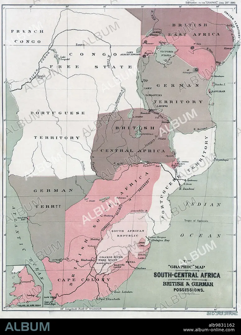
Map of south-Central Africa showing British and German possessions in the 1890s. After a map published in the June 25th, 1890 edition of The Graphic. The inset map, lower left, shows England on the same scale as the African map.
| Share |
|---|
 Pinterest Pinterest |
 Twitter Twitter |
 Facebook Facebook |
 Copy link Copy link |
 Email Email |
|
Add to another lightbox |
|
Add to another lightbox |


Buy this image.
Select the use:

Caption: Map of south-Central Africa showing British and German possessions in the 1890s. After a map published in the June 25th, 1890 edition of The Graphic. The inset map, lower left, shows England on the same scale as the African map.
Credit: Album / Ken Welsh/Universal History Archive/Universal Images Group
Releases: ? Model Release: No - ? Property Release: No
Rights questions?
Rights questions?
Image size: 4029 × 5315 px | 61.3 MB
Print size: 34.1 × 45.0 cm | 1586.2 × 2092.5 in (300 dpi)
Keywords: 1890'S • 19 CENTURY • 19TH CENTURY • 19TH CENTURY. • 19TH • 19TH-CENTURY • AFRICA • AFRICAN • ARCHIVAL • ARCHIVE • ARCHIVES • BLACK PERSON • BLACK RACE • BLACK • BRITAIN • BRITISH POSSESSIONS • BRITISH • CARTOGRAPHY • COLONIALISM • COLONIES • COLONY • CONSTRUCTION_AND_PROPERTY • COUNTRY • DEPENDENCY • DOMINION • ENGLAND'S • ENGLAND • ENGLISH • EUROPEAN POSSESSIONS • GEOGRAFIA • GEOGRAPHICAL • GEOGRAPHY • GERMAN POSSESSIONS • GERMAN • GERMANS • GERMANY • GRAPHIC, THE • GREAT BRITAIN • GREAT-BRITAIN • HISTORIA UNIVERSAL • HISTORIA • HISTORICAL • HISTORY • HISTORY. • ILLUSTRATION • ILLUSTRATIONS • ILUSTRATION • INGLES • MAP MAKING • NEGRA • NINETEENTH CENTURY • OCCUPIED • OLD • OVERSEAS • POSSESSION • PROPERTY • PROTECTORATE • TERRITORIES • TERRITORY • U. K. • UNITED KINGDOM • UNSPECIFIED • WHITE • XIX CENTURY
