alb2012088
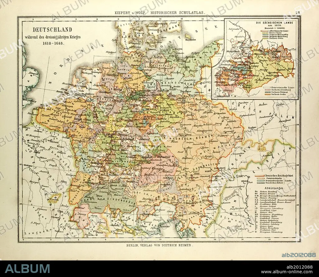
MAP OF GERMANY DURING THE THIRTY YEARS' WAR, 1618 - 1648.
| Share |
|---|
 Pinterest Pinterest |
 Twitter Twitter |
 Facebook Facebook |
 Copy link Copy link |
 Email Email |
|
Add to another lightbox |
|
Add to another lightbox |


Buy this image.
Select the use:

Caption: MAP OF GERMANY DURING THE THIRTY YEARS' WAR, 1618 - 1648
Credit: Album / quintlox
Releases: ? Model Release: No - ? Property Release: No
Rights questions?
Rights questions?
Image size: 4656 × 3797 px | 50.6 MB
Print size: 39.4 × 32.1 cm | 1833.1 × 1494.9 in (300 dpi)
Keywords: 1618 • 1648 • GERMANY • MAP • MAPS • NINETEENTH CENTURY MAP • PLAN (CARTOGRAPHY) • THIRTY YEARS WAR • THIRTY YEARS' WAR • WAR, THIRTY YEARS
