alb4085389
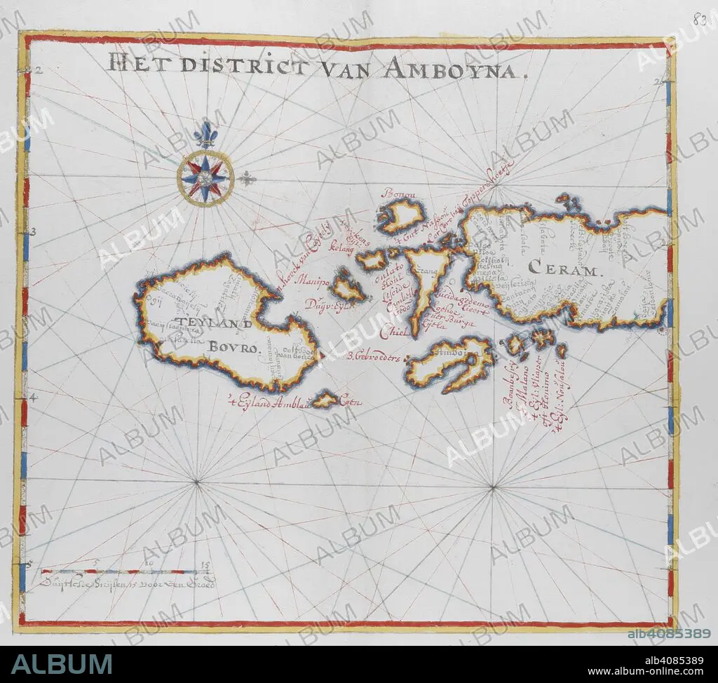
Map showing the islands of Bouro and Ceram (Seram), Indonesia. DUTCH PORTOLANO, containing forty-nine coloured maps and views. 17th century. Source: Add. 34184, f.82.
| Share |
|---|
 Pinterest Pinterest |
 Twitter Twitter |
 Facebook Facebook |
 Copy link Copy link |
 Email Email |
|
Add to another lightbox |
|
Add to another lightbox |


Buy this image.
Select the use:

Caption:
Map showing the islands of Bouro and Ceram (Seram), Indonesia. DUTCH PORTOLANO, containing forty-nine coloured maps and views. 17th century. Source: Add. 34184, f.82.
Credit:
Album / British Library
Releases:
Model: No - Property: No
Rights questions?
Rights questions?
Image size:
4421 x 3977 px | 50.3 MB
Print size:
37.4 x 33.7 cm | 14.7 x 13.3 in (300 dpi)
Keywords:
17TH CENTURY • 17TH • ASIA • CARTE • CARTOGRAPHIC • CARTOGRAPHY • CHART • INDONESIA • INDONESIAN FOLK ART • INDONESIAN • MAP MAKING • MAP • MAPS • PLAN (CARTOGRAPHY) • SOUTHEAST ASIA • XVII CENTURY
