alb4522964
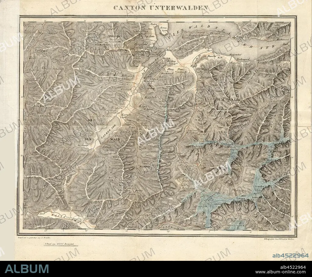
Canton Unterwalden, Map of the area Unterwalden (today: Nidwalden and Obwalden), signed: Edited u., struck by C. brother; Lithograph by J. H. Neeb, Taf. 1, after p. 199, Bruder, C. (bearb. u. gest.);, Neeb, J. H. (lith.), Aloys Businger: Historisch-geographisch-statistisches Gemälde der Schweiz. Heft 6. St. Gallen, Bern: bei Huber und Compagnie, 1836.
| Share |
|---|
 Pinterest Pinterest |
 Twitter Twitter |
 Facebook Facebook |
 Copy link Copy link |
 Email Email |
|
Add to another lightbox |
|
Add to another lightbox |


Buy this image.
Select the use:

Caption:
Canton Unterwalden, Map of the area Unterwalden (today: Nidwalden and Obwalden), signed: Edited u., struck by C. brother; Lithograph by J. H. Neeb, Taf. 1, after p. 199, Bruder, C. (bearb. u. gest.);, Neeb, J. H. (lith.), Aloys Businger: Historisch-geographisch-statistisches Gemälde der Schweiz. Heft 6. St. Gallen, Bern: bei Huber und Compagnie, 1836
Credit:
Album / quintlox
Releases:
Image size:
4645 x 3882 px | 51.6 MB
Print size:
39.3 x 32.9 cm | 15.5 x 12.9 in (300 dpi)
Keywords:
1836 • ALOYS BUSINGER • AREA UNTERWALDEN • ARTFORM: LITHOGRAPH • BEARB. U. GEST. • BEI HUBER • BERN • BRUDER • C. BROTHER • C. • CANTON UNTERWALDEN • COMPAGNIE • CONTEMPORARY • EDITED U. • HEFT 6 • HISTORISCH-GEOGRAPHISCH-STATISTISCHES GEMÄLDE DER SCHWEIZ • J. H. NEEB • J. H. • LITH. • LITHOGRAPH • LITHOGRAPHER • LITHOGRAPHY • MAP • MAPS • NEEB • NIDWALDEN • OBWALDEN • P. 199 • PLAN (CARTOGRAPHY) • SIGNED • ST. GALLEN • STRUCK • TAF. 1 • TODAY
