alb9843752
HENDRIK DE LETH, JAN DANIEL KNAPP. Accurate Map of the state and the course of Rio de Berbice..., 1742. Creators: Jan Daniel Knapp, Hendrik de Leth.
| Share |
|---|
 Pinterest Pinterest |
 Twitter Twitter |
 Facebook Facebook |
 Copy link Copy link |
 Email Email |
|
Add to another lightbox |
|
Add to another lightbox |


Author:
Title:
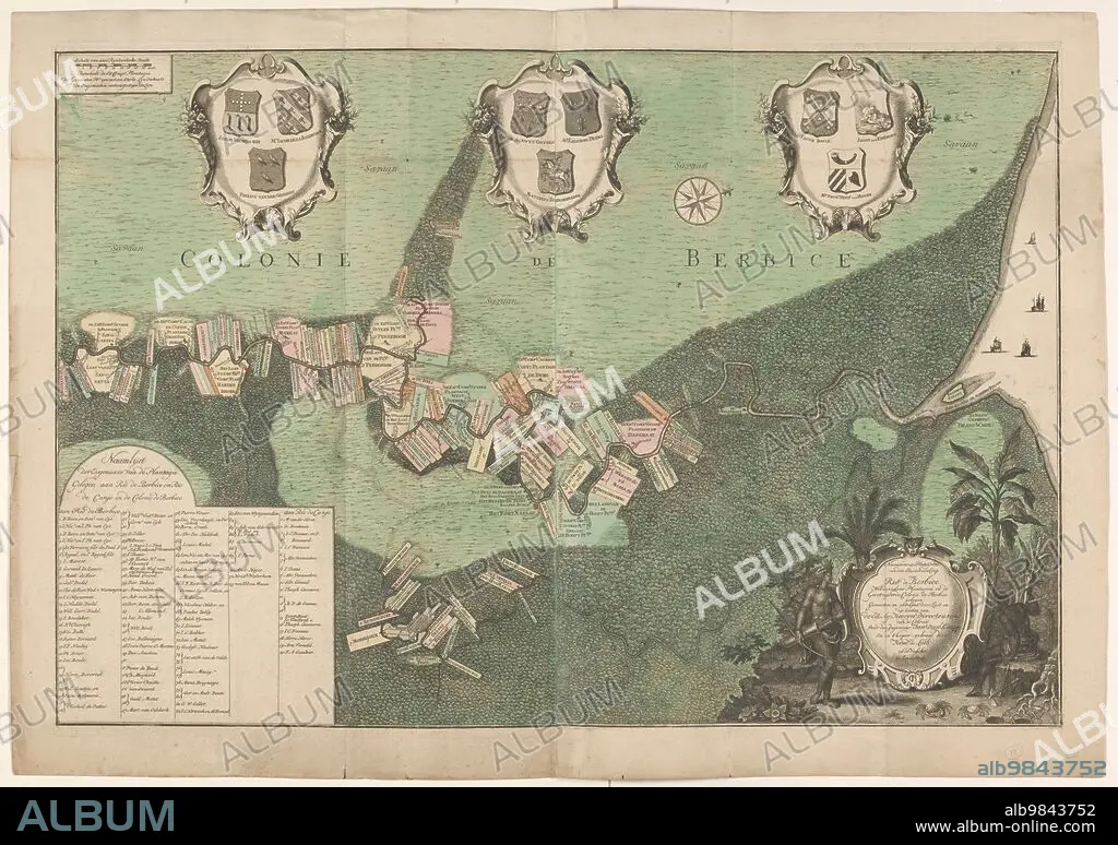
Accurate Map of the state and the course of Rio de Berbice..., 1742. Creators: Jan Daniel Knapp, Hendrik de Leth.
Caption:
Accurate Map of the state and the course of Rio de Berbice. Located with the same Plantation in the Colony of Berbice, 1742. Map, on two sheets, of the Dutch West India Company colony of Berbice, showing the plantations along the Berbice and Canje rivers. Bottom left: 'Name list of the owners of the Plantations located on Rio de Berbice and Rio de Canje in the Colonie de Berbice': Total 113. Above: three cartouches with coats of arms. Cartouche with an indigenous resident of Guyana and an enslaved man. (The region along the Berbice River in Guyana was a colony of the Dutch West India Company between 1627 and 1792).
Personalities:
Credit:
Album / Heritage Art/Heritage Images
Releases:
Model: No - Property: No
Rights questions?
Rights questions?
Image size:
7986 x 5626 px | 128.5 MB
Print size:
67.6 x 47.6 cm | 26.6 x 18.8 in (300 dpi)
Keywords:
18TH CENTURY • 18TH CENTURY, THE • 18TH • AGRICULTURE • AMERINDIAN • ARC • ARCH • ARCHES • ARCHWAY • ARCO • ARMS • ARMS: BOW AND ARROW • ARROW • ARROWS • ART • ARTS • BERBICE RIVER • BERBICE • BLACK • BLAZON • BOW (WEAPON) • BOW AND ARROW • BOW • CENTURY • COAT OF ARMS • COATS OF ARMS • COLONIAL • COLONIALISM • COLONY • COLOR • COLOUR • CONCEPT • CONTINENT • DUTCH WEST INDIA COMPANY • DUTCH • EIGHTEENTH CENTURY • ENGRAVED • ENGRAVING • ENSLAVED PERSON • ETCHED • ETCHING • EUROPE • GATEWAY • GEOGRAPHICAL FEATURE • GEOGRAPHY • GUYANA • HENDRIK DE LETH II • HENDRIK DE LETH • HENDRIK DE • HERALDIC • HERALDRY • HUNDRED YEARS WAR • IMPERIALISM • INDÍGENA • INDIGENAS • INDIGÈNE • INDIGENOUS PEOPLE • INDIGENOUS • JAN DANI? L KNAPP • JAN DANI? L • JAN DANIEL KNAPP • JAN DANIEL • KNAPP • LAND • LETH • LOCAL • LOCATION • LOW COUNTRIES • MAP • MUSEUM • NATIVE • NATIVES • NETHERLANDS • OCCUPATION • OCCUPIED TERRITORY • OWNER • OWNERS • PAPER • PEOPLE • PLANTATION • PLANTATIONS • PRINT • PROPERTY • RIJKSMUSEUM • RIVER • SHIELD OF ARMS • SLAVE • SLAVERY • SOUTH AMERICA • SOUTH AMERICAN • TERRITORIAL • TERRITORY • WAR • WARFARE • WARS • WATERCOLOUR (PAINT) • WATERCOLOUR • WEAPON • WEAPONARY • WEAPONRY • WEAPONS • WIC • XVIII CENTURY
