alb1654527
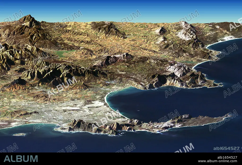
Cape Town and Cape of Good Hope, South Africa, in foreground of perspective view generated from Landsat satellite image and elevation data from the Shuttle Radar Topography Mission (SRTM). Credit NASA. Science Earth Geology.
| Share |
|---|
 Pinterest Pinterest |
 Twitter Twitter |
 Facebook Facebook |
 Copy link Copy link |
 Email Email |
|
Add to another lightbox |
|
Add to another lightbox |


Buy this image.
Select the use:

Caption: Cape Town and Cape of Good Hope, South Africa, in foreground of perspective view generated from Landsat satellite image and elevation data from the Shuttle Radar Topography Mission (SRTM). Credit NASA. Science Earth Geology
Category: UIG HISTORY
Credit: Album / Universal History Archive/Universal Images Group
Releases: ? Model Release: No - ? Property Release: No
Rights questions?
Rights questions?
Image size: 5291 × 3336 px | 50.5 MB
Print size: 44.8 × 28.2 cm | 2083.1 × 1313.4 in (300 dpi)
Keywords: AFRICA • AFRICAN • ASTRONOMIA • ASTRONOMY • CAPE • CIENCIA • CLOSE UP • CLOSE-UP • CLOSEUP • CREDIT • DATA • EARTH • ELEVATION • FOREGROUND • GENERATED • GEOLOGIA • GEOLOGY • GOOD • HOPE • IMAGE • LANDSAT • METEOROLOGY • METEOROLOGY • MISSION • NASA • PANORAMIC VIEW • PERSPECTIVE • PHOTOGRAPH • RADAR • SATELLITE • SCIENCE • SCIENCES • SHUTTLE • SOUTH • SRTM • STANDPOINT • TOPOGRAPHY • TOWN • UIG HISTORY • VIEW • VIEWPOINT • WEATHER
