alb3846242
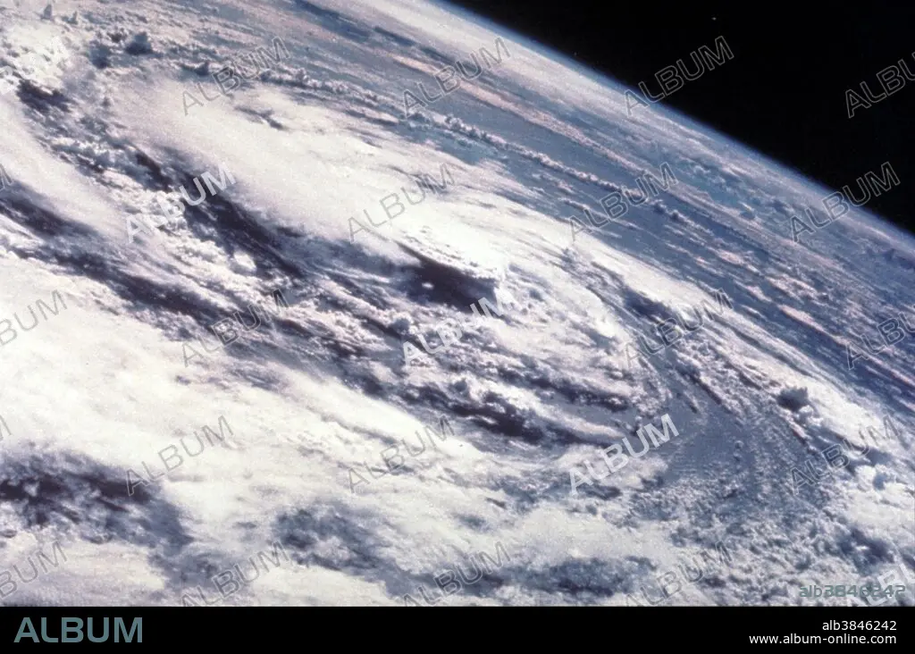
Hurricane Gladys, Apollo 7 Image, 1975
| Share |
|---|
 Pinterest Pinterest |
 Twitter Twitter |
 Facebook Facebook |
 Copy link Copy link |
 Email Email |
|
Add to another lightbox |
|
Add to another lightbox |


Buy this image.
Select the use:

Title:
Hurricane Gladys, Apollo 7 Image, 1975
Caption:
Hurricane Gladys, Gulf of Mexico, as seen from the Apollo 7 spacecraft during its 91st revolution of the earth. Photographed from an altitude of 99 nautical miles, at ground elapsed time of 144 hours and 27 minutes. Hurricane Gladys was the farthest tropical cyclone from the United States to be observed by radar in the Atlantic basin since Hurricane Carla in 1961. The seventh named storm and fifth hurricane of the 1975 Atlantic hurricane season, Gladys developed from a tropical wave while several hundred miles southwest of Cape Verde on September 22. Initially, the tropical depression failed to strengthened significantly, but due to warm sea surface temperatures and low wind shear, it became Tropical Storm Gladys by September 24. Despite entering a more unfavorable environment several hundred miles east of the northern Leeward Islands, Gladys became a Category 1 hurricane on the Saffir-Simpson hurricane wind scaleon September 28. Shortly thereafter, the storm reentered an area favorable for strengthening. Eventually, a well-defined eye became visible on satellite imagery.
Credit:
Album / NASA/Science Source
Releases:
Model: No - Property: No
Rights questions?
Rights questions?
Image size:
2967 x 1966 px | 16.7 MB
Print size:
25.1 x 16.6 cm | 9.9 x 6.6 in (300 dpi)
Keywords:
APOLLO 7 IMAGE • APOLLO 7 • APOLLO SEVEN • ATMOSPHERE • CENTRAL EYE • CLOUD • CLOUDS • CYCLONE • CYCLONIC FLOW • DAMAGE • DESTRUCTION • EARTH IMAGERY • EYE OF HURRICANE • FROM SPACE • HURRICANE GLADYS • HURRICANE • HURRICANES • HURTING • METEOROLOGY • METEOROLOGY • NATURAL DISASTER • NATURAL DISASTERS • NATURAL PHENOMENA • NATURAL PHENOMENON • PHENOMENON • PRECIPITATION • RAIN • RAINFALL • RAINING • SCIENCE • STORM DAMAGE • STORM • TORNADOS • TROPICAL STORM DAMAGE • TROPICAL STORM • TYPHOON • WEATHER • WIND
