alb6418789
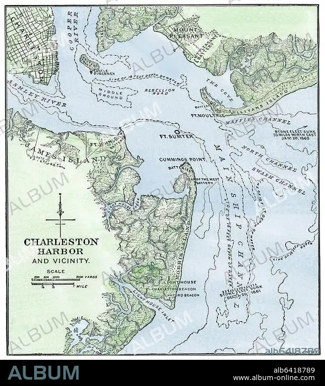
Map showing location of Fort Sumter, Civil War
| Share |
|---|
 Pinterest Pinterest |
 Twitter Twitter |
 Facebook Facebook |
 Copy link Copy link |
 Email Email |
|
Add to another lightbox |
|
Add to another lightbox |


Buy this image.
Select the use:

Title:
Map showing location of Fort Sumter, Civil War
Caption:
See automatic translation
l War
Credit:
Album / akg/North Wind Picture Archives
Releases:
Model: No - Property: No
Rights questions?
Rights questions?
Image size:
3036 x 3364 px | 29.2 MB
Print size:
25.7 x 28.5 cm | 10.1 x 11.2 in (300 dpi)
Keywords:
19 CENTURY • 19TH CENTURY • 19TH • 19TH-CENTURY • AMERICA • ART • ARTS • ARTWORK • CHART • CIVIL WAR • DIAGRAM • EE. UU. • ESTADOS UNIDOS USA EEUU EE. UU. EUA E. U. A. • FINE ARTS • FORT SUMTER • FORT • HISTORIA UNIVERSAL • HISTORIA • HISTORY • HUNDRED YEARS WAR • ILLUSTRATION • ILLUSTRATIONS • LEGEND • MAP • MAPS • MILITAR • MILITARS • MILITARY • NINETEENTH CENTURY • NORTH AMERICA • PHOTOGRAPH • PHOTOGRAPHY • PLAN (CARTOGRAPHY) • RUGGED • SHARP • SOUTH CAROLINA • SOUTH • STRONG • U. S. A. • U.S. • UNITED STATES OF AMERICA • UNITED STATES • UNITED STATES, THE • UNITES STATES OF AMERICA USA • USA • WAR • WARFARE • WARS • WORK OF ART • XIX CENTURY
