alb9226744
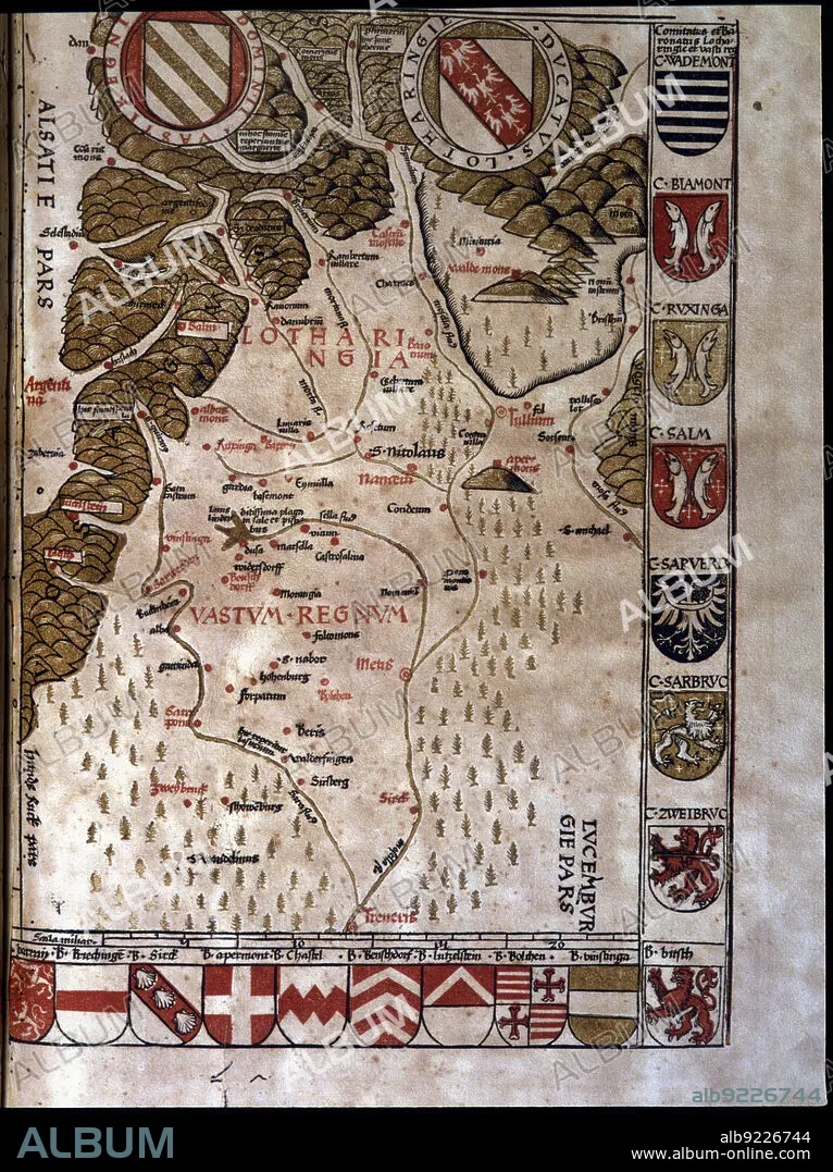
Map of the Duchy of Lotaringia, now Lorraine (France), 1596. Creator: Ptolomeo, Claudio. (90-168).
| Share |
|---|
 Pinterest Pinterest |
 Twitter Twitter |
 Facebook Facebook |
 Copy link Copy link |
 Email Email |
|
Add to another lightbox |
|
Add to another lightbox |


Buy this image.
Select the use:

Title:
Map of the Duchy of Lotaringia, now Lorraine (France), 1596. Creator: Ptolomeo, Claudio. (90-168).
Caption:
Map of the Duchy of Lotaringia, now Lorraine (France). In'Geographiae Universae', 1596.
Credit:
Album / Index/Heritage Images
Releases:
Image size:
4865 x 6507 px | 90.6 MB
Print size:
41.2 x 55.1 cm | 16.2 x 21.7 in (300 dpi)
Keywords:
16 16TH XVI XVITH SIXTEENTH CENTURY • 16 CENTURY • 16TH CENTURY • 16TH • BARCELONA • CATALUNYA • CLAUDIO. (90-168) • CLAUDIUS • COLOR • COLOUR • CURRENTLY • DUCHY • FLUSH • FRANCE • GEOGRAPHIAE • INDEX FOTOTECA • LIBRARY • LORRAINE • LOTARING • LOTHRINGEN • MAP • MAPS • PORTULANOS • PTOLOMEO • SPAIN • UNIVERSAE • UNIVERSITY LIBRARY • UNIVERSITY • XVI CENTURY
