alb9203717
First Map of North and South America, 1544
| Share |
|---|
 Pinterest Pinterest |
 Twitter Twitter |
 Facebook Facebook |
 Copy link Copy link |
 Email Email |
|
Add to another lightbox |
|
Add to another lightbox |


Title:
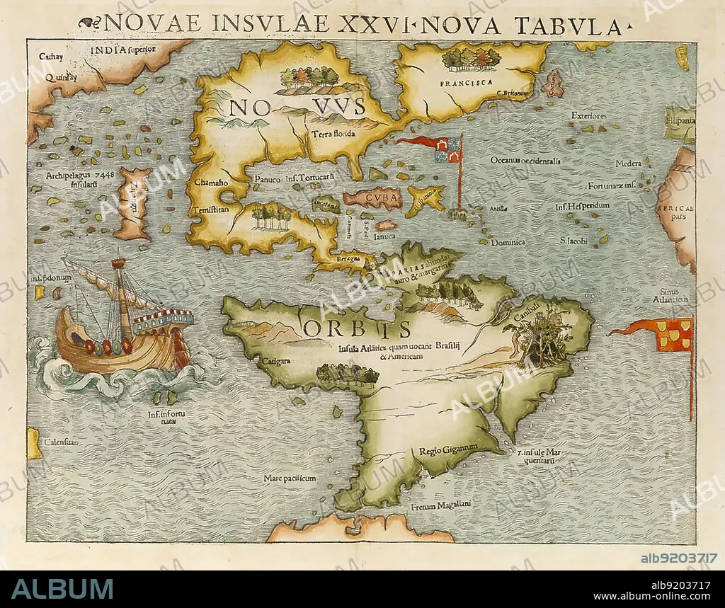
First Map of North and South America, 1544
Caption:
Map of showing North and South America as the New World. The map first appeared in Sebastian Münster's Cosmographia in 1544. It is considered the first to show the entire continents of North and South America.
Credit:
Album / Science Source
Releases:
Model: No - Property: No
Rights questions?
Rights questions?
Image size:
Not available
Print size:
Not available
Keywords:
1540S • 1544 • 16 16TH XVI XVITH SIXTEENTH CENTURY • 16 CENTURY • 16TH CENTURY • 16TH • AMERICA • ANTIQUE • ATLANTIC • CENTURY • CONTINENT • COSMOGRAPHIA • FIRST • FLEET • HISTORIC • HISTORY • ILLUSTRATION • ILLUSTRATIONS • MAP • MARINE • MUNSTER • NAVY • NEW • NORTH • OCEAN • OLD • SEA • SEAS • SEBASTIAN • SOUTH • WORLD
