alb5475616
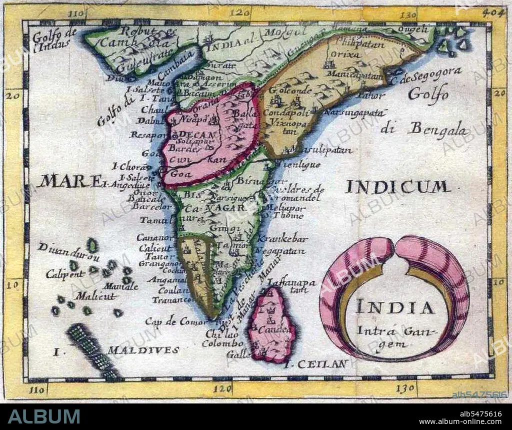
India Intra-Gangem', a miniature map of the Malabar and Coromandel coasts.
| Share |
|---|
 Pinterest Pinterest |
 Twitter Twitter |
 Facebook Facebook |
 Copy link Copy link |
 Email Email |
|
Add to another lightbox |
|
Add to another lightbox |


Title:
India Intra-Gangem', a miniature map of the Malabar and Coromandel coasts.
Caption:
In classical usage, 'India Intra Gangem' refers to South Asia west of the Ganges, while 'India Extra Gangem' refers to peninsular Southeast Asia.
Credit:
Album / Pictures From History/Universal Images Group
Releases:
Model: No - Property: No
Rights questions?
Rights questions?
Image size:
4380 x 3449 px | 43.2 MB
Print size:
37.1 x 29.2 cm | 14.6 x 11.5 in (300 dpi)
Keywords:
ARABIAN SEA • ASIA • ASIAN • BAY OF BENGAL • CHART • COROMANDEL • HISTORIA UNIVERSAL • HISTORICAL • HISTORY • INDIA • INDIAN OCEAN • INDIAN • INDIGENOUS PEOPLES OF THE AMERICAS • INDIO • KERALA • MALABAR • MALDIVES • MAP • MAPS • OLD CEYLON • PLAN (CARTOGRAPHY) • SRI LANKA • TAMIL NADU
