alb2202089
Topographic Map of Central America-1850 1850
| Share |
|---|
 Pinterest Pinterest |
 Twitter Twitter |
 Facebook Facebook |
 Copy link Copy link |
 Email Email |
|
Add to another lightbox |
|
Add to another lightbox |


Buy this image.
Select the use:

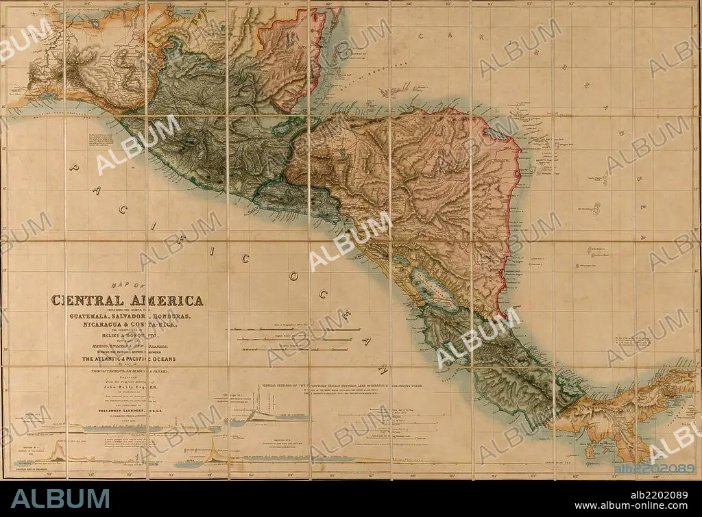
Title: Topographic Map of Central America-1850 1850
Caption: Map of Central America including the states of Guatemala, Salvador, Honduras, Nicaragua & Costa Rica, the territories of Belise & Mosquito, with parts of Mexico, Yucatan & New Granada : shewing the proposed routes between the Atlantic & Pacific Oceans by way of Tehuantepeque, Nicaragua & Panama; Includes four "vertical sections of the proposed canals between Lake Nicaragua & the Pacific Ocean"
Credit: Album / Universal Images Group / Universal History Archive/UIG
Releases: ? Model Release: No - ? Property Release: No
Rights questions?
Rights questions?
Image size: 7299 × 5002 px | 104.5 MB
Print size: 61.8 × 42.4 cm | 2873.6 × 1969.3 in (300 dpi)
Keywords: 1850 • AMERICA NORTH • BRITISH HONDURAS • CARTOGRAPHIC • CARTOGRAPHY • CENTRAL AMERICA • COSTA RICA • GUATAMALA • HONDOURAS • ISTHMUS • MAP MAKING • MAP • MAPS • NORTH AMERICA • NORTH AMERICAN • PANAMA • PLAN (CARTOGRAPHY) • SALVADOR
