alb2095013
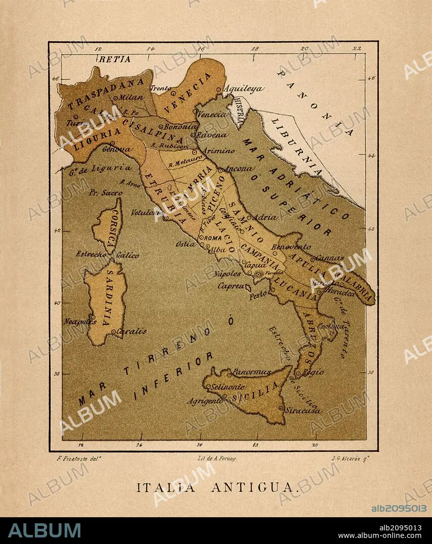
Mapa de Italia Antigua publicado en el libro Historia Universal, de Felipe Picatoste. Madrid, 1890.
| Share |
|---|
 Pinterest Pinterest |
 Twitter Twitter |
 Facebook Facebook |
 Copy link Copy link |
 Email Email |
|
Add to another lightbox |
|
Add to another lightbox |


Buy this image.
Select the use:

Caption:
Automatic translation: Map of Ancient Italy published in the book Historia Universal, by Felipe Picatoste. Madrid, 1890
Mapa de Italia Antigua publicado en el libro Historia Universal, de Felipe Picatoste. Madrid, 1890
Credit:
Album / Documenta
Releases:
Model: No - Property: No
Rights questions?
Rights questions?
Image size:
3933 x 4710 px | 53.0 MB
Print size:
33.3 x 39.9 cm | 13.1 x 15.7 in (300 dpi)
Keywords:
ANTIQUITY • CIVILIZATION • CORSICA • EUROPA • EUROPE • HISTORIA UNIVERSAL • HISTORIA • HISTORY • HISTORY. • ITALIA • ITALY • MAP • MAPS • MEDITERRANEAN SEA • MEDITERRANEAN • MEDITERRANEO • PLAN (CARTOGRAPHY) • SICILY
