alb1962114
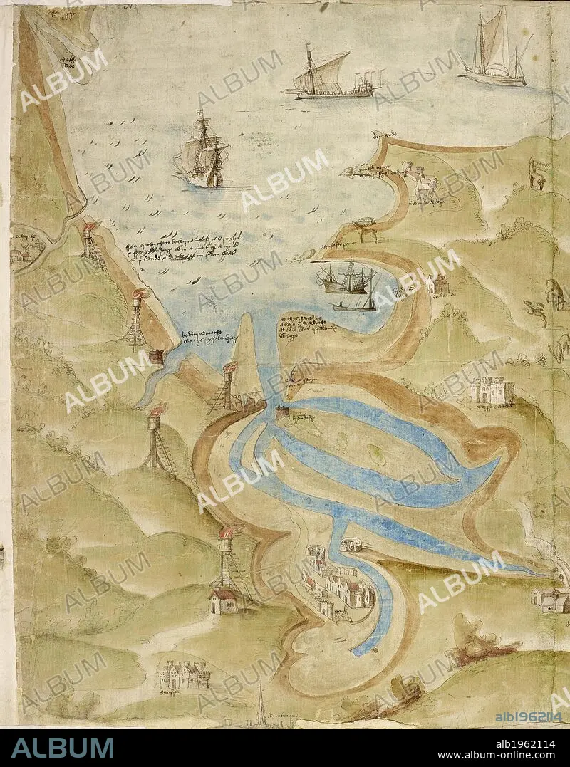
Map of Mount's Bay in Cornwall. Coastline. Sand flats and sheltered estuary and bay. Ships. . A Large colored chart of Mount’s Bay, in Cornwall. Cornwall, drawn c. 1540. A Large colored chart of Mount’s Bay, in Cornwall, drawn c. 1540. . Source: Cotton Augustus I. I 31-33 (detail). Language: English.
| Share |
|---|
 Pinterest Pinterest |
 Twitter Twitter |
 Facebook Facebook |
 Copy link Copy link |
 Email Email |
|
Add to another lightbox |
|
Add to another lightbox |


Buy this image.
Select the use:

Caption:
Map of Mount's Bay in Cornwall. Coastline. Sand flats and sheltered estuary and bay. Ships. . A Large colored chart of Mount’s Bay, in Cornwall. Cornwall, drawn c. 1540. A Large colored chart of Mount’s Bay, in Cornwall, drawn c. 1540. . Source: Cotton Augustus I. I 31-33 (detail). Language: English.
Credit:
Album / British Library
Releases:
Model: No - Property: No
Rights questions?
Rights questions?
Image size:
4866 x 6226 px | 86.7 MB
Print size:
41.2 x 52.7 cm | 16.2 x 20.8 in (300 dpi)
Keywords:
BAHIA • BAY • BOATS' MOORING • BRITAIN • BRITISH ISLES • CARTOGRAPHY • COAST • CORNWALL • ENGLAND'S • ENGLAND • EUROPA • EUROPE • GREAT BRITAIN • GREAT-BRITAIN • GULF • HARBOR • HARBOUR • MAP MAKING • MAP • MAPS • MARITIME STRUCTURE • PLAN (CARTOGRAPHY) • PORT • SHIP • SHIPS • TOPOGRAPHY • TRANSPORTATION • U. K. • UNITED KINGDOM • WATER VEHICLE • WESTERN EUROPE
