alb9527663
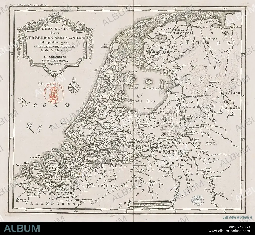
Historical map of Holland in the Middle Ages, Old map of the now united Netherlands to elucidate patriotic history in the Middle Ages (title on object), Eighteenth-century map of Holland in the Middle Ages. Title cartouche to the left. Right scale bar: German mylen of 15 in a degree, Dutch mylen or hours gaans. Degree divisions along edges., print maker: anonymous, publisher: Isaak Tirion, (mentioned on object), Amsterdam, 1749, paper, engraving, height 289 mm × width 329 mm.
| Share |
|---|
 Pinterest Pinterest |
 Twitter Twitter |
 Facebook Facebook |
 Copy link Copy link |
 Email Email |
|
Add to another lightbox |
|
Add to another lightbox |


Buy this image.
Select the use:

Caption:
Historical map of Holland in the Middle Ages, Old map of the now united Netherlands to elucidate patriotic history in the Middle Ages (title on object), Eighteenth-century map of Holland in the Middle Ages. Title cartouche to the left. Right scale bar: German mylen of 15 in a degree, Dutch mylen or hours gaans. Degree divisions along edges., print maker: anonymous, publisher: Isaak Tirion, (mentioned on object), Amsterdam, 1749, paper, engraving, height 289 mm × width 329 mm
Credit:
Album / quintlox
Releases:
Image size:
2914 x 2534 px | 21.1 MB
Print size:
24.7 x 21.5 cm | 9.7 x 8.4 in (300 dpi)
Keywords:
15 • 1749 • AMSTERDAM • ANONYMOUS • DEGREE DIVISIONS • DEGREE • DUTCH MYLEN • EDGES • EIGHTEENTH-CENTURY MAP • ELUCIDATE PATRIOTIC HISTORY • ENGRAVED • ENGRAVING (ARTWORK) • ENGRAVING • ENGRAVING. • ENGRAVINGS • ETCHING • GERMAN MYLEN • GRADE • HEIGHT 289 MM × WIDTH 329 MM • HISTORICAL MAP • HOLLAND • HOURS GAANS • ISAAK TIRION • LEFT • MENTIONED • MIDDLE AGES • NOW UNITED NETHERLANDS • OBJECT • OBJECTS • OLD MAP • PAPER AND PACKAGE PRODUCTS • PAPER • PRINT MAKER • PRINT • PUBLISHER • RIGHT SCALE BAR • TITLE CARTOUCHE • TITLE • UMBRELLA
