alb2180635
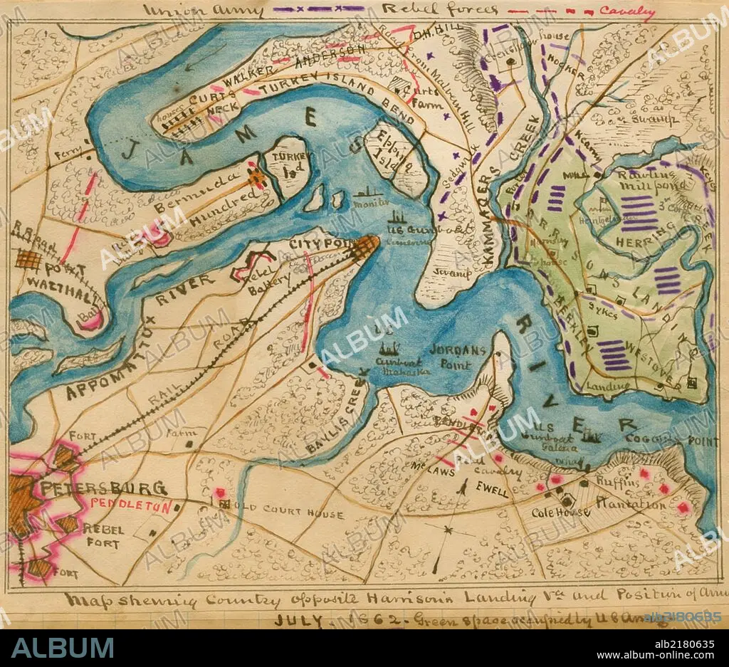
Harrison's Landing, Va., and position of U. S. Army. 1862
| Share |
|---|
 Pinterest Pinterest |
 Twitter Twitter |
 Facebook Facebook |
 Copy link Copy link |
 Email Email |
|
Add to another lightbox |
|
Add to another lightbox |


Buy this image.
Select the use:

Title: Harrison's Landing, Va., and position of U. S. Army. 1862
Caption: location along the James River between Petersburg and Harrison's Landing, Va., of the camps of the U.S. Army of the Potomac after the Seven Days' Battles, 26 June-1 July 1862. Positions of U.S. gunboats are indicated along the James River as well as Confederate strongholds and positions of the Cavalry.
Credit: Album / Universal Images Group / Universal History Archive/UIG
Releases: ? Model Release: No - ? Property Release: No
Rights questions?
Rights questions?
Image size: 1891 × 1633 px | 8.8 MB
Print size: 16.0 × 13.8 cm | 744.5 × 642.9 in (300 dpi)
Keywords: 1862 • ARGYLE • ARMIES ARMY • ARMIES • ARMY'S • ARMY • CARTOGRAPHIC • CARTOGRAPHY • CIVIL • COCKSPUR • FÉDÉRAL • FORT • GEORGIA • GUERRA • HAND COLORED • HUNDRED YEARS WAR • MAP MAKING • MAP • MAPS • NORDEN • NORTH • PLAN (CARTOGRAPHY) • POTOMAC • PULASKI • SAVANNAH • SHERMAN • TYBEE • UNION • WAR • WARFARE • WARS
