alb3830460
Surtsey Volcanic Island, 1960s
| Share |
|---|
 Pinterest Pinterest |
 Twitter Twitter |
 Facebook Facebook |
 Copy link Copy link |
 Email Email |
|
Add to another lightbox |
|
Add to another lightbox |


Buy this image.
Select the use:

Title:
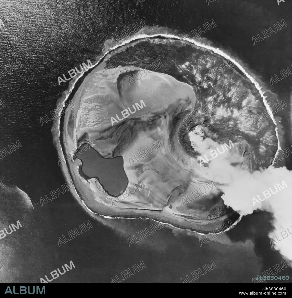
Surtsey Volcanic Island, 1960s
Caption:
An aerial photograph of Surtsey, a volcanic island near Iceland's southwestern coast, which was formed following an eruption in 1963. Surtsey is a volcanic island located in the Vestmannaeyjar archipelago off the southern coast of Iceland. It was formed in a volcanic eruption which began 426 feet below sea level, and reached the surface on November 14, 1963. The eruption lasted until June 5, 1967, when the island reached its maximum size of 1.0 square mile. Since then, wave erosion has caused the island to steadily diminish in size: as of 2012, its surface area was 0.50 square miles. The most recent survey (2007) shows the island's maximum elevation at 509 feet above sea level.
Credit:
Album / Science Source / Omikron
Releases:
Model: No - Property: No
Rights questions?
Rights questions?
Image size:
4029 x 3900 px | 45.0 MB
Print size:
34.1 x 33.0 cm | 13.4 x 13.0 in (300 dpi)
Keywords:
1960S • 1963 • 1963-67 • 20 XX TWENTIETH CENTURY • 20TH CENTURY • 20TH • 60 60'S DECADE SIXTY YEARS • 60 60'S DECADE YEARS SIXTY SIXTIES • 60S • AERIAL • ASH CLOUD • BW • CELEBRITIES • CELEBRITY • CRATER (GEOLOGY) • CRATER • CRATER, VOLCANO • EARTH SCIENCE • ERUPTING • ERUPTION • EVENT • EVENTS • EXTRUSION • EXTRUSIVE • FAMOUS PEOPLE • FAMOUS • GEOCHEMICAL • GEOLOGIA • GEOLOGIC HAZARD • GEOLOGICAL • GEOLOGY • GEOPHYSICAL • HISTORIC • HISTORICAL • HISTORY • ICELAND • ICELANDIC • IMPORTANT • ISLAND • NATURAL DISASTER • NOTABLE • PHENOMENA • PHENOMENON • PHOTO • PHOTOGRAPH • SCIENCE • SIXTIES • SIXTIES, THE • SURTSEY • TWENTIETH CENTURY • VOLCANIC • VOLCANO • VOLCANOLOGY • VULCAN • VULCANO • VULCANOLOGY • WELL-KNOWN • YEARS DECADE'S SIXTY SIXTIES 60 60 1960
