alb3408391
Map of Java in the Dutch East Indies, circa 1680, 17th century.
| Share |
|---|
 Pinterest Pinterest |
 Twitter Twitter |
 Facebook Facebook |
 Copy link Copy link |
 Email Email |
|
Add to another lightbox |
|
Add to another lightbox |


Title:
Map of Java in the Dutch East Indies, circa 1680, 17th century.
Caption:
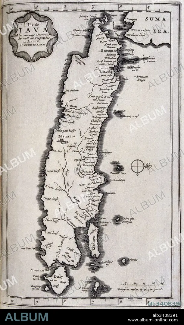
Map of Java in the Dutch East Indies, circa 1680, 17th century. Illustration from voyages made to Persia and India 1727, by Johan Albrecht de Mandelslo (1616–1644). seventeenth-century German adventurer, who wrote about his travels through Persia and India.
Credit:
Album / Universal Images Group / Universal History Archive \ UIG
Releases:
Model: No - Property: No
Rights questions?
Rights questions?
Image size:
3043 x 5100 px | 44.4 MB
Print size:
25.8 x 43.2 cm | 10.1 x 17.0 in (300 dpi)
Keywords:
17TH CENTURY • 17TH • BOOK • CARTOGRAPHY • DUTCH EAST INDIES • FULL FRAME • HISTORIA UNIVERSAL • HISTORY • ILLUSTRATION • ILLUSTRATIONS • INDIA • JAVA • JOHAN ALBRECHT DE MANDELSLO • LIBRO • MAP MAKING • MAP • MAPS • NO PEOPLE • PAST, THE • PLAN (CARTOGRAPHY) • STUDIO SHOT • VERTICAL LINES • VERTICAL • VOYAGES MADE TO PERSIA AND INDIA • WITHOUT PEOPLE
