alb3547538
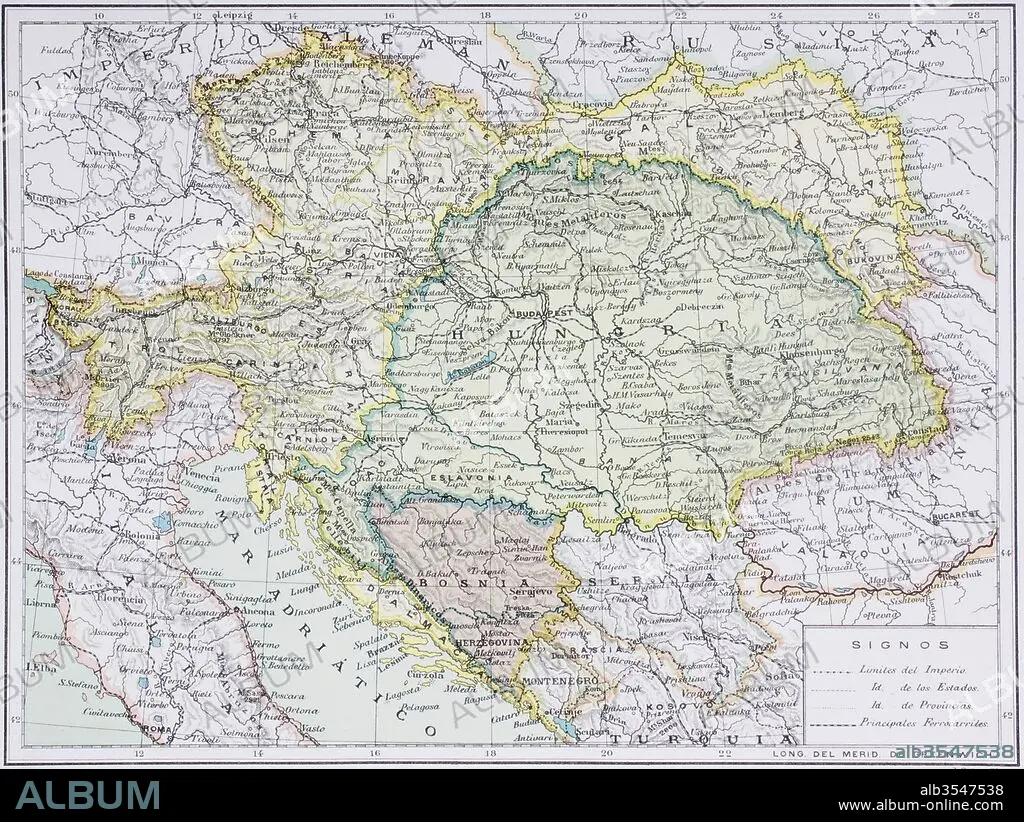
Map of the Austro-Hungarian empire at the turn of the 20th century
| Share |
|---|
 Pinterest Pinterest |
 Twitter Twitter |
 Facebook Facebook |
 Copy link Copy link |
 Email Email |
|
Add to another lightbox |
|
Add to another lightbox |


Buy this image.
Select the use:

Title: Map of the Austro-Hungarian empire at the turn of the 20th century
Caption: Map of the Austro-Hungarian empire at the turn of the 20th century. Map is in Spanish language. From Enciclopedia Ilustrada Seguí, published Barcelona circa 1910.
Credit: Album / Universal Images Group / Universal History Archive
Releases: ? Model Release: No - ? Property Release: No
Rights questions?
Rights questions?
Image size: 5079 × 3815 px | 55.4 MB
Print size: 43.0 × 32.3 cm | 1999.6 × 1502.0 in (300 dpi)
Keywords: 20 20TH XX XXTH TWENTIETH CENTURY • 20 XX TWENTIETH CENTURY • 20TH CENTURY • 20TH • AUSTRIA • AUSTRIA-HUNGARY • AUSTRIAN • AUSTRO-HUNGARIAN • BEFORE • CENTURY • DECADE • EMPIRE • FIRST • GUERRA • HUNDRED YEARS WAR • HUNGARIAN • HUNGARY • I • KINGDOM • MAP • MAPS • ONE • PLAN (CARTOGRAPHY) • PRIOR • TURN • TWENTIETH CENTURY • TWENTIETH • UNION • WAR • WARFARE • WARS • WORLD
