alb5938969
ANONYMOUS. Peutinger Table / 9th Sheet / 1264
| Share |
|---|
 Pinterest Pinterest |
 Twitter Twitter |
 Facebook Facebook |
 Copy link Copy link |
 Email Email |
|
Add to another lightbox |
|
Add to another lightbox |


Buy this image.
Select the use:

Author:
Title:
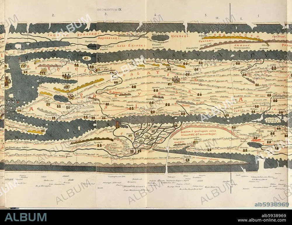
Peutinger Table / 9th Sheet / 1264
Caption:
Geography / Maps of the World. Peutinger Table (copy of a map of the Romam empire (version of C3rd AD) made in 1264); 9th sheet: Asia Minor and Egypt. Colour lithograph. From: World map of Castorius, called the Peutinger Table, published by Konrad Miller, Ravensburg (O.Maier) 1888. Berlin, Museum für Kommunikation.
Project:
MAP OF CASTORIUS
Technique/material:
GRAPHIC ART • PRINT (ART)
Museum:
Berlin, Museum für Kommunikation
Credit:
Album / akg-images
Releases:
Model: No - Property: No
Rights questions?
Rights questions?
Image size:
4961 x 3555 px | 50.5 MB
Print size:
42.0 x 30.1 cm | 16.5 x 11.8 in (300 dpi)
Keywords:
13TH CENTURY • 13TH • 2ND MILLENNIUM A. D. • 3RD CENTURY A. D. • 3RD CENTURY AD • 3RD CENTURY • A. D. 3RD CENTURY • ALEXANDRIA • ANCIENT WORLD • ANONYMOUS • ANTIGUEDAD • ANTIQUITIES • ANTIQUITY • ASIA MINOR • BEACON • BERLIN • BERLIN, MUSEUM FÜR KOMMUNIKATION • BYZANTINE EMPIRE • CARTOGRAPHY • DETAIL • EGYPT • EGYPTE • EGYPTIAN • EGYPTIANS • EXCERPT • GEOGRAFIA • GEOGRAPHY • GRAPHIC ART • GRAPHIC ARTS • HEADLIGHT • KONRAD MILLER • LIGHT HOUSE • LIGHTHOUSE • LITHOGRAPH • MAP MAKING • MAP OF CASTORIUS • MAP OF THE WORLD • PARTIAL VIEW • PRINT (ART) • PRINTED GRAPHICS • ROAD MAP • ROAD NETWORK • ROAD SYSTEM • ROMAN EMPIRE • S. III DC • S. III • SIGLO III D. C. • STREET NETWORK • THIRD CENTURY • TRAFFIC AND TRANSPORTATION • TRAFFIC • TRANSPORTATION • WORLD MAP • XIII CENTURY
