alb2595446
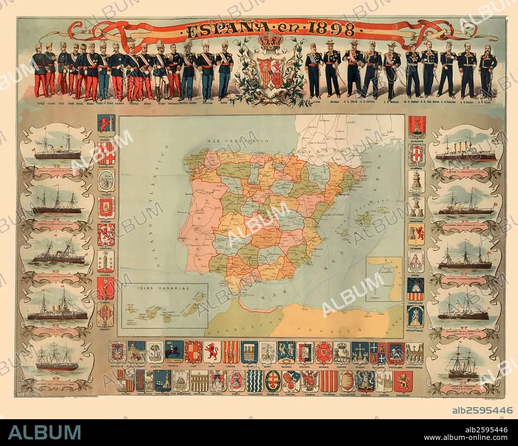
Mapa de España en 1898 con los escudos de las provincias, estados mayores de los ejércitos y escuadra de guerra de la época.
| Share |
|---|
 Pinterest Pinterest |
 Twitter Twitter |
 Facebook Facebook |
 Copy link Copy link |
 Email Email |
|
Add to another lightbox |
|
Add to another lightbox |


Buy this image.
Select the use:

Caption:
Automatic translation: Map of Spain in 1898 with the shields of the provinces, army headquarters and war squad of the time
Mapa de España en 1898 con los escudos de las provincias, estados mayores de los ejércitos y escuadra de guerra de la época.
Credit:
Album / Documenta
Releases:
Model: No - Property: No
Rights questions?
Rights questions?
Image size:
5100 x 4127 px | 60.2 MB
Print size:
43.2 x 34.9 cm | 17.0 x 13.8 in (300 dpi)
