alb4088374
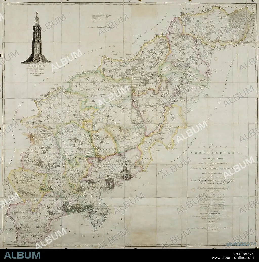
THOMAS JEFFREYS and W FADEN. 18th century map of the county of Northamptonshire. . The County of Northamptonshire, as surveyed and planned by the late T. Eyre, revised by the late T. Jefferys, and engraved by W. Faden. London, 1779. Source: Maps*4420.(3).
| Share |
|---|
 Pinterest Pinterest |
 Twitter Twitter |
 Facebook Facebook |
 Copy link Copy link |
 Email Email |
|
Add to another lightbox |
|
Add to another lightbox |


Buy this image.
Select the use:

Author: THOMAS JEFFREYS • W FADEN
Caption: 18th century map of the county of Northamptonshire. . The County of Northamptonshire, as surveyed and planned by the late T. Eyre, revised by the late T. Jefferys, and engraved by W. Faden. London, 1779. Source: Maps*4420.(3).
Credit: Album / British Library
Releases: ? Model Release: No - ? Property Release: No
Rights questions?
Rights questions?
Image size: 6647 × 6367 px | 121.1 MB
Print size: 56.3 × 53.9 cm | 2616.9 × 2506.7 in (300 dpi)
Keywords: 18TH CENTURY • 18TH CENTURY, THE • 18TH CENTURY. • 18TH • ALBION • BRITAIN • BRITISH ISLES • CARTE • CARTOGRAPHIC • CARTOGRAPHY • COLOR • COLORS • COLOUR • COLOURS • ENGLAND'S • ENGLAND • EUROPA • EUROPE • FADEN, W • FLUSH • GREAT BRITAIN • GREAT-BRITAIN • JEFFREYS, THOMAS • MAP MAKING • MAP • MAPS • NORTHAMPTONSHIRE • PLAN (CARTOGRAPHY) • U. K. • UNITED KINGDOM • WESTERN EUROPE • XVIII CENTURY
