alb2009420
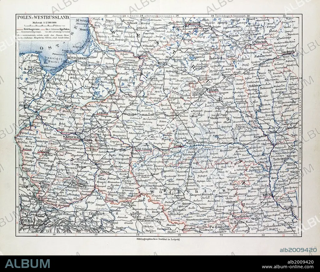
MAP OF POLAND, BELARUS AND UKRAINE, 1899.
| Share |
|---|
 Pinterest Pinterest |
 Twitter Twitter |
 Facebook Facebook |
 Copy link Copy link |
 Email Email |
|
Add to another lightbox |
|
Add to another lightbox |


Buy this image.
Select the use:

Caption:
MAP OF POLAND, BELARUS AND UKRAINE, 1899
Credit:
Album / quintlox
Releases:
Image size:
6091 x 4863 px | 84.7 MB
Print size:
51.6 x 41.2 cm | 20.3 x 16.2 in (300 dpi)
Keywords:
1899 • BELARUS • COMMUNISM: POLAND • MAP • MAPS • MINSK • NINETEENTH CENTURY MAP • PLAN (CARTOGRAPHY) • POLAND • POLAND: COMMUNISM • POLAND: POSTWAR • POSTWAR: POLAND • UCRANIA • UKRAINE • WARSAW
