alb9231631
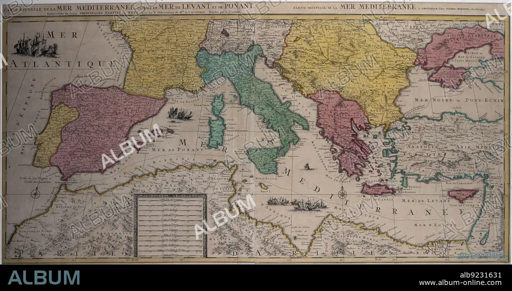
Marine chart of the eastern part of the Mediterranean Sea with the entire African coast..., 17th cen Creator: Sanson, Nicolás (1600-1667) .
| Share |
|---|
 Pinterest Pinterest |
 Twitter Twitter |
 Facebook Facebook |
 Copy link Copy link |
 Email Email |
|
Add to another lightbox |
|
Add to another lightbox |


Buy this image.
Select the use:

Title:
Marine chart of the eastern part of the Mediterranean Sea with the entire African coast..., 17th cen Creator: Sanson, Nicolás (1600-1667) .
Caption:
Marine chart of the eastern part of the Mediterranean Sea with the entire African coast to Egypt and the Red Sea and part of the Black Sea, 17th century. Edited in Amsterdam by Pierre Mortier.
Credit:
Album / Arxiu Delstres - Index/Heritage Images
Releases:
Model: No - Property: No
Rights questions?
Rights questions?
Image size:
7200 x 3718 px | 76.6 MB
Print size:
61.0 x 31.5 cm | 24.0 x 12.4 in (300 dpi)
Keywords:
17TH CENTURY • AFRICAN • AMSTERDAM • ANATOLIA • ASIAN • BLACK • CHART • COAST • COLOR • COLOUR • CYPRUS • EASTERN • EDITED • EGYPT • EUROPE • INDEX FOTOTECA • MADE • MAPS • MARINE • MEDITERRANEAN • MORTIER • NICOL? S (1600-1667) • NICOLÁS (1600-1667) • PART • PIERRE • PORTULANS • PRIVATE COLLECTION • RED • SANSÓN • SEA • TURKEY • WHOLE
