alb5750419
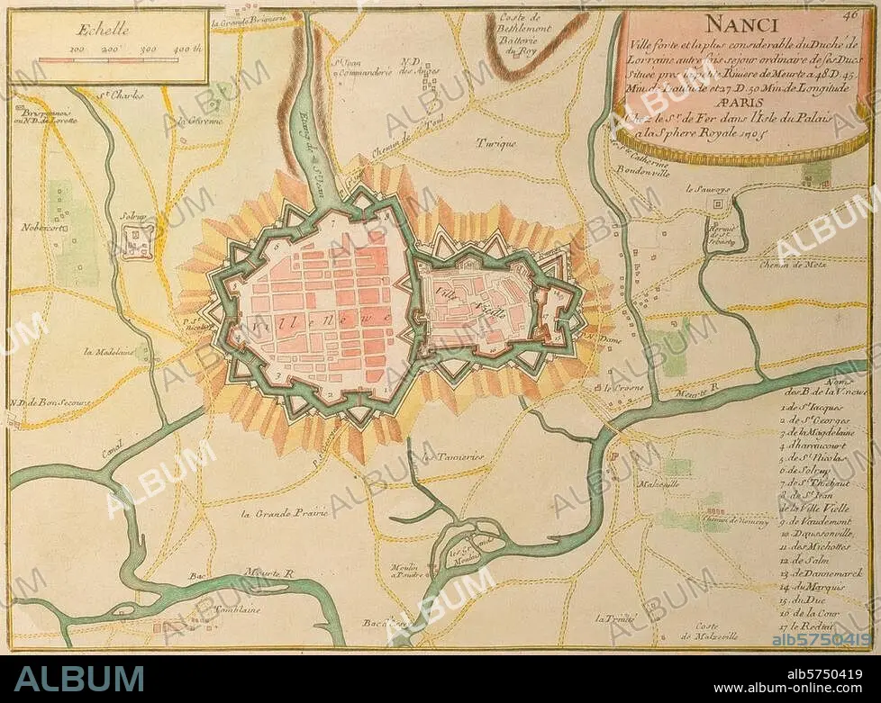
Carte de Nancy et environs 1705
| Share |
|---|
 Pinterest Pinterest |
 Twitter Twitter |
 Facebook Facebook |
 Copy link Copy link |
 Email Email |
|
Add to another lightbox |
|
Add to another lightbox |


Buy this image.
Select the use:

Title: Carte de Nancy et environs 1705
Caption: See automatic translation
Nancy (Meurthe-et-Moselle). "NANCI". (Carte de Nancy et environs). Gravure sur cuivre, coloriée. Paris (de Fer) 1705. Paris, coll. particulière.
Nancy (Meurthe-et-Moselle). "NANCI". (Carte de Nancy et environs). Gravure sur cuivre, coloriée. Paris (de Fer) 1705. Paris, coll. particulière.
Credit: Album / akg-images
Releases: ? Model Release: No - ? Property Release: No
Rights questions?
Rights questions?
Image size: 3364 × 2503 px | 24.1 MB
Print size: 28.5 × 21.2 cm | 1324.4 × 985.4 in (300 dpi)
Keywords: 18TH CENTURY • 18TH CENTURY, THE • 18TH CENTURY. • 18TH • 2ND MILLENNIUM A. D. • FRANCE • GEOGRAFIA • GEOGRAPHY • MAP • MAPS • MEURTHE-ET-MOSELLE • NANCY • PLAN (CARTOGRAPHY) • TOPOGRAPHY • XVIII CENTURY
