alb5336913
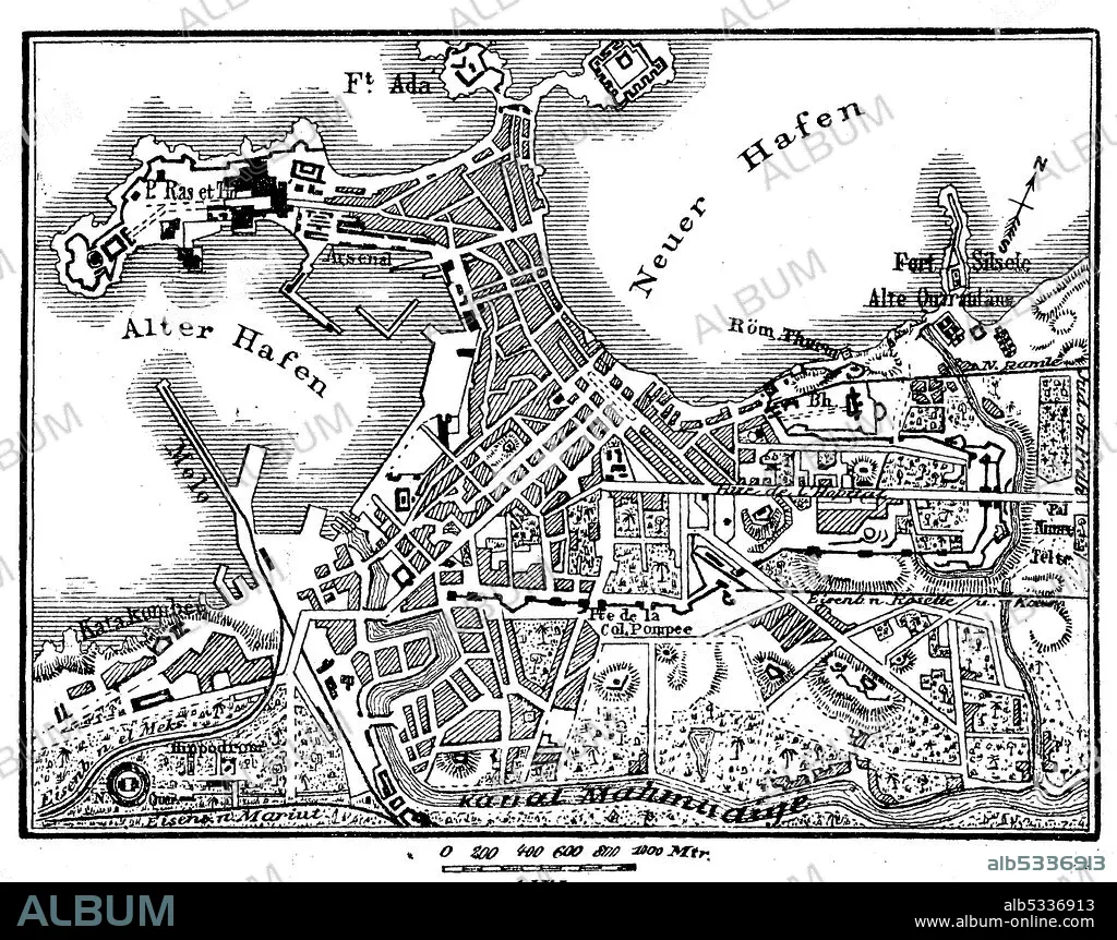
Map of Alexandria in Egypt in 1880 / Plan von Alexandria in Ägypten im Jahre 1880
| Share |
|---|
 Pinterest Pinterest |
 Twitter Twitter |
 Facebook Facebook |
 Copy link Copy link |
 Email Email |
|
Add to another lightbox |
|
Add to another lightbox |


Buy this image.
Select the use:

Title:
Map of Alexandria in Egypt in 1880 / Plan von Alexandria in Ägypten im Jahre 1880
Caption:
Map of Alexandria in Egypt in 1880 / Plan von Alexandria in Ägypten im Jahre 1880, Historisch, historical, digital improved reproduction of an original from the 19th century / digitale Reproduktion einer Originalvorlage aus dem 19. Jahrhundert,.
Credit:
Album / Universal Images Group / Bildagentur-online / UIG
Releases:
Model: No - Property: No
Rights questions?
Rights questions?
Image size:
5000 x 3952 px | 56.5 MB
Print size:
42.3 x 33.5 cm | 16.7 x 13.2 in (300 dpi)
Keywords:
1880 • AGED • ALEXANDRIA • ARCHIV • ARCHIVE • ARCHIVES • ART • ARTS • ATLAS • BLACK PERSON • BLACK RACE • BLACK • BLACK-AND-WHITE • BREEDING • CITY MAP • DESIGNING • DRAWING • DRAWINGS • DRAWN • EGYPT • EGYPTIAN • EGYPTIANS • EMBLEM • FRÜHER • GEGENSTAND • GEGENSTÄNDE • GESCHICHTE • HISTORIA UNIVERSAL • HISTORIA • HISTORIC ILLUSTRATION • HISTORIC • HISTORICAL • HISTORICALLY • HISTORISCH • HISTORISCHE ABBILDUNG • HISTORISCHE • HISTORY • HOLZSCHNITT • HOLZSCHNITTE • ILLUSTRATION • ILLUSTRATIONS • IM • IN • JAHRE • LANDKARTE • LANDKARTEN • LEGEND • MAP • MAPS • NEGRA • OF • ORIENTIERUNG • PLAN (CARTOGRAPHY) • PLAN • REPRO • REPRODUCTION • REPRODUKTION • ROAD MAP • SCHWARZ UND WEIß • SCHWARZ • SIMBOLOS • SKETCH • STADTPLAN • STRASSENKARTE • SYMBOL • SYMBOLFOTO • SYMBOLISCH • SYMBOLISCHE • SYMBOLISCHER • SYMBOLISCHES • SYMBOLS • VERGANGENE ZEIT • VINTAGE • VON • WEIß • WHITE • WOOD-CUT • WOODBLOCK PRINT • WOODCUT • WOODCUTS • XYLOGRAPHY • ZEICHNUNG • ZEICHNUNGEN • ZEITGENÖSSISCH • ZZBAGT-ONL • ÄGYPTEN
