alb5409621
Slave Trade of Africa Map,1899
| Share |
|---|
 Pinterest Pinterest |
 Twitter Twitter |
 Facebook Facebook |
 Copy link Copy link |
 Email Email |
|
Add to another lightbox |
|
Add to another lightbox |


Buy this image.
Select the use:

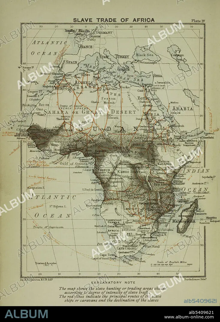
Title: Slave Trade of Africa Map,1899
Caption: A map of the slave trade in Africa that shows the regions of most intense activity. The map shows the slave hunting or trading areas shaded according to degree of intensity of slave traffic. The red lines indicate the principal routes of the slave ships or caravans and the destination of the slaves.
Credit: Album / NYPL/Science Source
Releases: ? Model Release: No - ? Property Release: No
Rights questions?
Rights questions?
Image size: 3441 × 4800 px | 47.3 MB
Print size: 29.1 × 40.6 cm | 1354.7 × 1889.8 in (300 dpi)
Keywords: 1899 • 19TH CENTURY • AFRICA • AFRICAN CONTINENT • AFRICAN SLAVE TRADE • AFRICAN • ATLANTIC SLAVE TRADE • BW • CARIBBEAN SLAVE TRADE • CARTOGRAPHY • DESTINATION • HISTORY • INFAMOUS • MAP MAKING • MAP • ROUTE • SLAVERY
