alb9060589
A Korean map from 16th Century Joseon dynasty.
| Share |
|---|
 Pinterest Pinterest |
 Twitter Twitter |
 Facebook Facebook |
 Copy link Copy link |
 Email Email |
|
Add to another lightbox |
|
Add to another lightbox |


Buy this image.
Select the use:

Title: A Korean map from 16th Century Joseon dynasty.
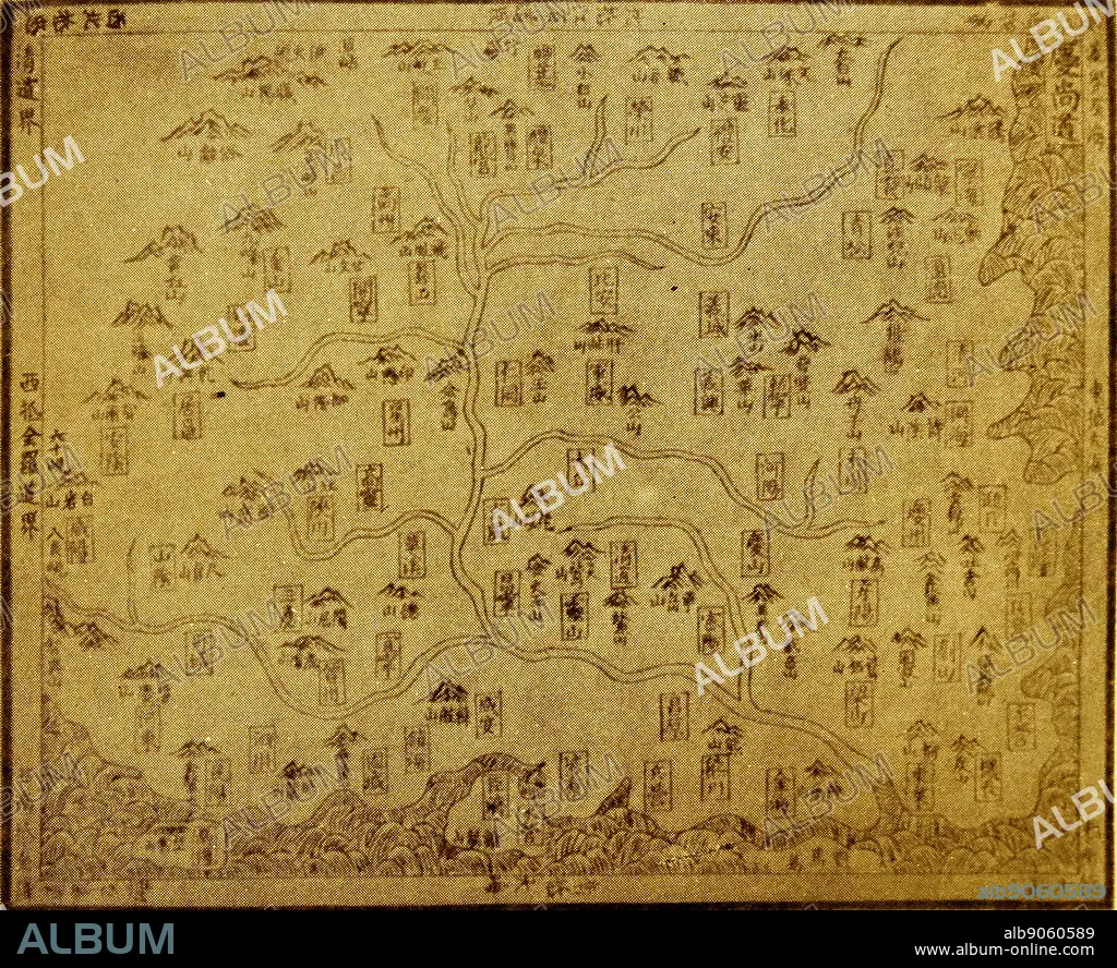
Caption: A 16th century map of Kyeong-sang-do province from the book Shin-jeung-Dong-guk-yeo-ji-seung-ram ("New Revised Edition of Dong-guk-Yeo-Ji-Seung-Ram")which is a Korean geography book that was published by the Joseon dynasty in 1530. The original wooden print is currently in Kyu-jang-gak, the royal library of the Joseon Dynasty, founded in 1776 by order of King Jeong-jo of Joseon.
Credit: Album / World History Archive
Releases: ? Model Release: No - ? Property Release: No
Rights questions?
Rights questions?
Image size: 5072 × 4135 px | 60.0 MB
Print size: 42.9 × 35.0 cm | 1996.9 × 1628.0 in (300 dpi)
Keywords: 15TH CENTURY • 18TH CENTURY • 18TH CENTURY, THE • 18TH CENTURY. • 18TH • CARTOGRAPHY • DONG-GUK-YEO-JI-SEUNG-RAM • DYNASTY • GEOGRAFIA • GEOGRAPHY • JEONG-JO • JOSEON • KING • KOREA • KOREAN • KYEONG-SANG-DO • MAP MAKING • MAP • SHIN-JEUNG-DONG-GUK-YEO-JI-SEUNG-RAM • XVIII CENTURY
