alb3969730
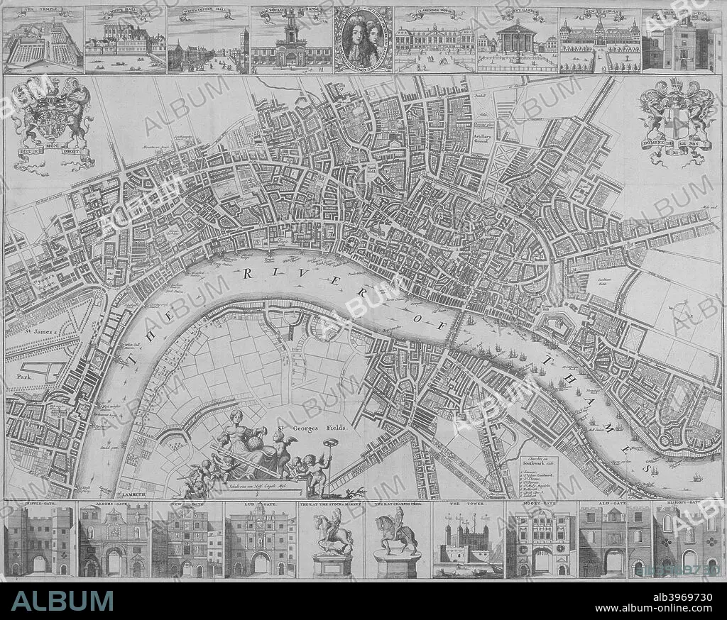
Map of the Cities of London and Westminster and Southwark, 1690. Artist: Anon
| Share |
|---|
 Pinterest Pinterest |
 Twitter Twitter |
 Facebook Facebook |
 Copy link Copy link |
 Email Email |
|
Add to another lightbox |
|
Add to another lightbox |


Title:
Map of the Cities of London and Westminster and Southwark, 1690. Artist: Anon
Caption:
Map of the Cities of London and Westminster and Southwark, 1690. With views of buildings and portraits of William III and Mary II in an oval in the top margin and gates, the Tower of London and statues of Charles I and Charles II in the lower margin.
Credit:
Album / The London Archives (City of London)/Heritage Images
Releases:
Model: No - Property: No
Rights questions?
Rights questions?
Image size:
2803 x 2248 px | 18.0 MB
Print size:
23.7 x 19.0 cm | 9.3 x 7.5 in (300 dpi)
Keywords:
17TH CENTURY • ANON • ANONYMOUS • B & W • B / W • B&W • BLACK & WHITE • BLACK AND WHITE • BRITAIN • BRITISH • CARTOGRAPHY • CENTURY • CITY OF LONDON • CITY OF WESTMINSTER • COAT OF ARMS • COUNTRY • ENGLAND • ENGLISH • ENGRAVING • GATE • GEOGRAPHICAL FEATURE • GEOGRAPHY • GUILDHALL LIBRARY & ART GALLERY • HERALDRY • KING OF ENGLAND • KING OF GREAT BRITAIN AND IRELAND • KING WILLIAM III • KING • LOCATION • LONDON • MAP MAKING • MAP • MAP-MAKING • MAR • MARY II • MARY STUART • MARY • MONARCH • MONOCHROMATIC • MONOCHROME • PEOPLE • PRINCE OF ORANGE • PRINCE WILLIAM OF ORANGE • QUEEN MARY II • QUEEN OF GREAT BRITAIN AND IRELAND • QUEEN • RIVER THAMES • RIVER • ROYAL • ROYALTY • SEVENTEENTH CENTURY • SOUTHWARK • SOVEREIGN • STATUE • STATUES • STUART • THAMES RIVER • THAMES • WESTMINSTER • WILLIAM III • WILLIAM OF ORANGE • WILLIAM STUART
