alb9020618
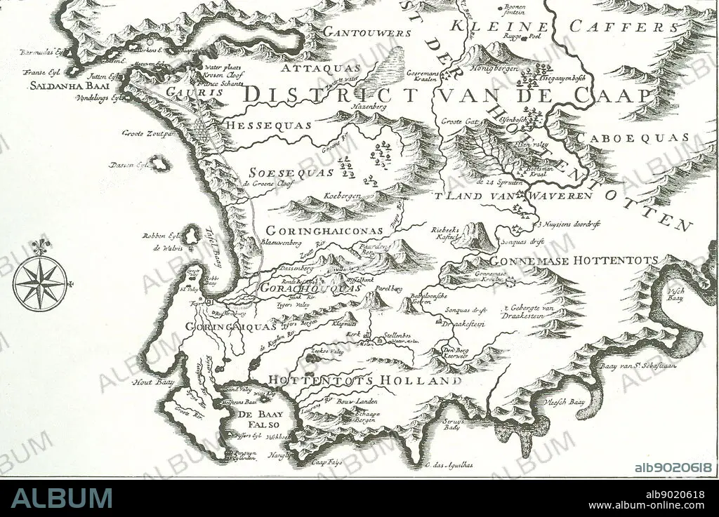
District of the Cape' (The Good Hope)' - map of a portion of the present Cape Colony. The former ship's doctor Johan van Riebeek landed in Table Bay in 1652 and built the beginning of a Dutch settlement in South Africa.
| Share |
|---|
 Pinterest Pinterest |
 Twitter Twitter |
 Facebook Facebook |
 Copy link Copy link |
 Email Email |
|
Add to another lightbox |
|
Add to another lightbox |


Buy this image.
Select the use:

Caption:
District of the Cape' (The Good Hope)' - map of a portion of the present Cape Colony. The former ship's doctor Johan van Riebeek landed in Table Bay in 1652 and built the beginning of a Dutch settlement in South Africa.
Credit:
Album / World History Archive
Releases:
Model: No - Property: No
Rights questions?
Rights questions?
Image size:
3700 x 2470 px | 26.1 MB
Print size:
31.3 x 20.9 cm | 12.3 x 8.2 in (300 dpi)
Keywords:
