alb4064224
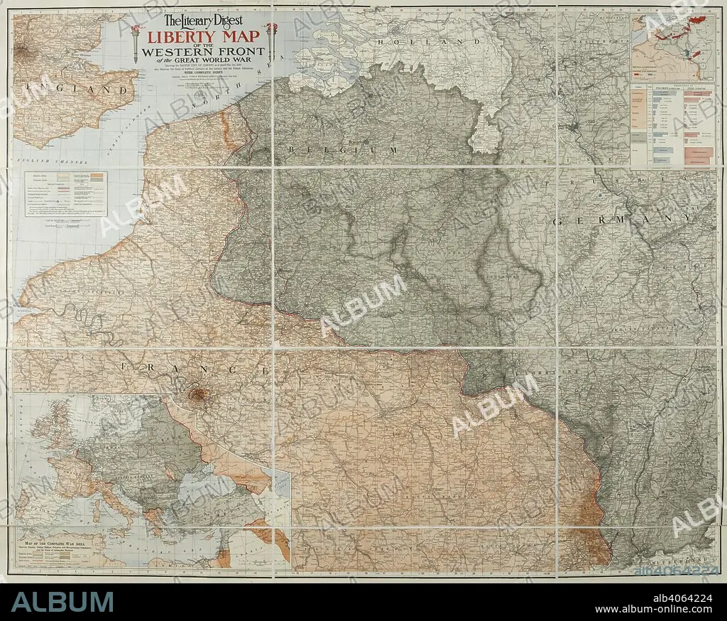
A map of the 'Western front' during the First World War. It covers mostly France, Belgium, Holland and Germany. The Literary Digest Liberty Map of the Western Front of the Great World War ... with complete index. Natural scale, 1 : 500,000. New York : Funk & Wagnalls, 1918. Source: Maps.14317.(90).
| Share |
|---|
 Pinterest Pinterest |
 Twitter Twitter |
 Facebook Facebook |
 Copy link Copy link |
 Email Email |
|
Add to another lightbox |
|
Add to another lightbox |


Buy this image.
Select the use:

Caption:
A map of the 'Western front' during the First World War. It covers mostly France, Belgium, Holland and Germany. The Literary Digest Liberty Map of the Western Front of the Great World War ... with complete index. Natural scale, 1 : 500,000. New York : Funk & Wagnalls, 1918. Source: Maps.14317.(90).
Credit:
Album / British Library
Releases:
Model: No - Property: No
Rights questions?
Rights questions?
Image size:
7526 x 6037 px | 130.0 MB
Print size:
63.7 x 51.1 cm | 25.1 x 20.1 in (300 dpi)
Keywords:
1ST WORLD WAR • 20 20TH XX XXTH TWENTIETH CENTURY • 20 XX TWENTIETH CENTURY • 20TH CENTURY • 20TH • ARMED CONFLICT • ARMED CONFLICTS • CARTE • CARTOGRAPHIC • CARTOGRAPHY • COLOR • COLORS • COLOUR • COLOURS • COMBAT • EVENT • EVENTS • FIRST WORLD WAR • GREAT WAR • GUERRA • HUNDRED YEARS WAR • I WORLD WAR • MAP MAKING • MAP • MAPS • MILITARY EVENT • MILITARY EVENTS • PLAN (CARTOGRAPHY) • TWENTIETH CENTURY • WAR • WARFARE • WARS • WORLD WAR 1 • WORLD WAR I (1914-18) • WORLD WAR I • WORLD WAR ONE • WORLD WAR • WW1 • WWI
