alb5486498
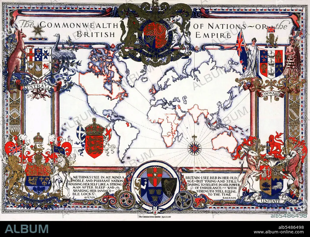
Map of the World showing the 'Commonwealth of Nations or the British Empire',1937.
| Share |
|---|
 Pinterest Pinterest |
 Twitter Twitter |
 Facebook Facebook |
 Copy link Copy link |
 Email Email |
|
Add to another lightbox |
|
Add to another lightbox |


Buy this image.
Select the use:

Title: Map of the World showing the 'Commonwealth of Nations or the British Empire',1937.
Caption: The British Empire comprised the dominions, colonies, protectorates, mandates and other territories ruled or administered by the United Kingdom. It originated with the overseas colonies and trading posts established by England in the late 16th and early 17th centuries. At its height, it was the largest empire in history and, for over a century, was the foremost global power. By 1922 the British Empire held sway over about 458 million people, one-fifth of the world's population at the time. The empire covered more than 33,700,000 km2 (13,012,000 sq mi), almost a quarter of the Earth's total land area. As a result, its political, legal, linguistic and cultural legacy is widespread.
Credit: Album / Pictures From History/Universal Images Group
Releases: ? Model Release: No - ? Property Release: No
Rights questions?
Rights questions?
Image size: 5000 × 3567 px | 51.0 MB
Print size: 42.3 × 30.2 cm | 1968.5 × 1404.3 in (300 dpi)
Keywords: ASIA • ASIAN • BRITAIN • BRITISH EMPIRE • CARTOGRAPHY • CHART • COLONIALISM • EMPIRE • ENGLAND'S • ENGLAND • GREAT BRITAIN • GREAT-BRITAIN • HISTORIA UNIVERSAL • HISTORIA • HISTORICAL • HISTORY • HISTORY. • IMPERIALISM • MAP MAKING • MAP • MAPS • PLAN (CARTOGRAPHY) • U. K. • UNITED KINGDOM
