alb15425852
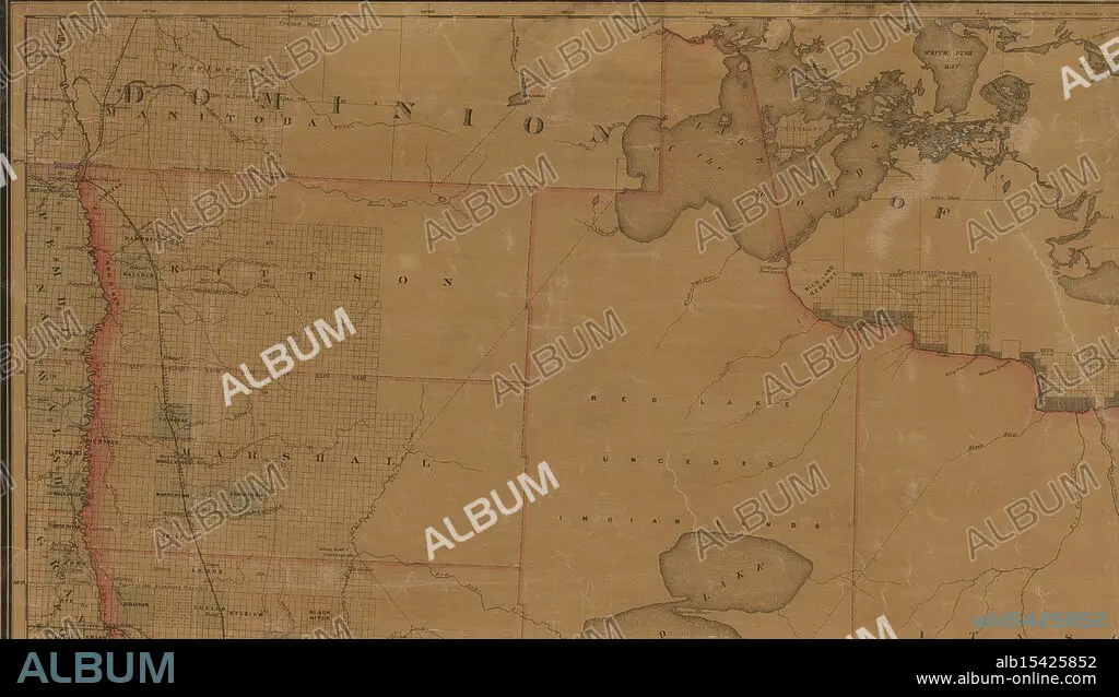
Map of the state of Minnesota and adjacent portions of Wisconsin, Iowa, Dakota and the Dominion of Canada, 1882, Warner & Foote, Date Issued: 1882, Place: Minneapolis, Minn., Publisher: Warner & Foote, Indians of North America, Administrative and political divisions, Extent: 1 map: hand colored, 176 x 151 cm, on sheet 186 x 168 cm, NYPL Map Div. copy isdivided into 8 sheets, 48 x 84 cm, or smaller, Ancient lands unite, Waters flow, borders clarify, Minnesota's birth.
| Share |
|---|
 Pinterest Pinterest |
 Twitter Twitter |
 Facebook Facebook |
 Copy link Copy link |
 Email Email |
|
Add to another lightbox |
|
Add to another lightbox |


Buy this image.
Select the use:

Caption:
Map of the state of Minnesota and adjacent portions of Wisconsin, Iowa, Dakota and the Dominion of Canada, 1882, Warner & Foote, Date Issued: 1882, Place: Minneapolis, Minn., Publisher: Warner & Foote, Indians of North America, Administrative and political divisions, Extent: 1 map: hand colored, 176 x 151 cm, on sheet 186 x 168 cm, NYPL Map Div. copy isdivided into 8 sheets, 48 x 84 cm, or smaller, Ancient lands unite, Waters flow, borders clarify, Minnesota's birth
Credit:
Album / quintlox
Releases:
Model: No - Property: No
Rights questions?
Rights questions?
Image size:
5200 x 2973 px | 44.2 MB
Print size:
44.0 x 25.2 cm | 17.3 x 9.9 in (300 dpi)
Keywords:
1 MAP • 1882 • 8 SHEETS • ADJACENT PORTIONS • ADMINISTRATIVE • CANADA • CANADA. • COPY ISDIVIDED • DAKOTA • DATE ISSUED • DOMINION • EXTENT • HAND COLORED • INDIANS • IOWA • MAP • MAPS • MINN • MINNEAPOLIS • MINNESOTA • NORTH AMERICA • NORTH AMERICAN • NYPL MAP DIV • PLACE • PLAN (CARTOGRAPHY) • POLITICAL DIVISIONS • PUBLISHER • SHEET • SMALLER • STATE • WARNER & FOOTE • WISCONSIN
