alb15422881
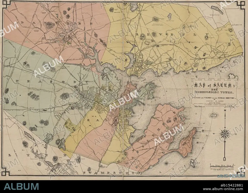
Map of Salem and surrounding towns, 1884, Date Issued: 1884, Place: Salem, Mass., Publisher: Henry M. Meek, Salem (Mass.), Essex County (Mass.), Massachusetts, Essex County, Massachusetts, Salem, Extent: 1 map: hand colored, 75 x 105 cm, on sheet 81 x 111 cm, Village streets unwind, Red brick paths to distant seas, Salem's secret lies.
| Share |
|---|
 Pinterest Pinterest |
 Twitter Twitter |
 Facebook Facebook |
 Copy link Copy link |
 Email Email |
|
Add to another lightbox |
|
Add to another lightbox |


Buy this image.
Select the use:

Caption:
Map of Salem and surrounding towns, 1884, Date Issued: 1884, Place: Salem, Mass., Publisher: Henry M. Meek, Salem (Mass.), Essex County (Mass.), Massachusetts, Essex County, Massachusetts, Salem, Extent: 1 map: hand colored, 75 x 105 cm, on sheet 81 x 111 cm, Village streets unwind, Red brick paths to distant seas, Salem's secret lies.
Personalities:
Credit:
Album / quintlox
Releases:
Model: No - Property: No
Rights questions?
Rights questions?
Image size:
5200 x 3778 px | 56.2 MB
Print size:
44.0 x 32.0 cm | 17.3 x 12.6 in (300 dpi)
Keywords:
1 MAP • 1884 • DATE ISSUED • ESSEX COUNTY • EXTENT • HAND COLORED • HENRY M • MAP • MAPS • MASS • MASSACHUSETTS • MEEK • PLACE • PLAN (CARTOGRAPHY) • PUBLISHER • SALEM • SHEET • SURROUNDING TOWNS
