alb8368770
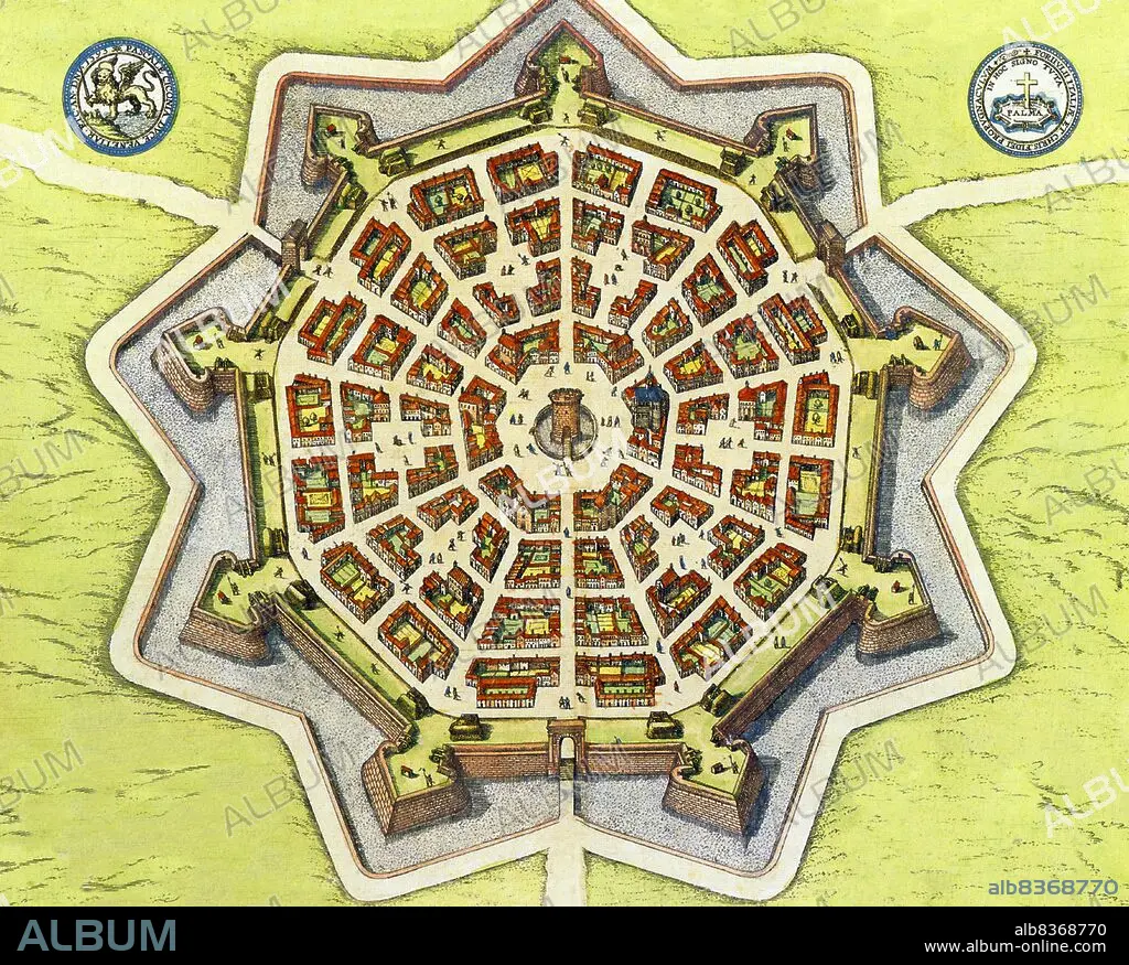
Italy: Map of the Venetian bastion fort Palmanova, from the Civitates Orbis Terrarum< / i> by Georg Braun (1541-1622), late 16th century-early 17th century
| Share |
|---|
 Pinterest Pinterest |
 Twitter Twitter |
 Facebook Facebook |
 Copy link Copy link |
 Email Email |
|
Add to another lightbox |
|
Add to another lightbox |


Buy this image.
Select the use:

Title:
Italy: Map of the Venetian bastion fort Palmanova, from the Civitates Orbis Terrarum< / i> by Georg Braun (1541-1622), late 16th century-early 17th century
Caption:
Palmanova is a town and municipality in northeastern Italy. It is an excellent example of a bastion / star fort of the design favoured in the Late Renaissance era. First built by the Venetians in 1593, the fort-town was designed by Vincenzo Scamozzi. A second phase of construction occurred between 1658 and 1690, with final fortifications completed under the Napoleonic domination of 1806-1813.
Credit:
Album / Universal Images Group / Pictures From History
Releases:
Model: No - Property: No
Rights questions?
Rights questions?
Image size:
4675 x 3751 px | 50.2 MB
Print size:
39.6 x 31.8 cm | 15.6 x 12.5 in (300 dpi)
Keywords:
16 16TH XVI XVITH SIXTEENTH CENTURY • 16 CENTURY • 16TH CENTURY • 16TH • 17TH CENTURY • 17TH • BASTION FORT • BASTION • BOOK • BOOKS • CIVITATES ORBIS TERRARUM • COMUNE • EUROPA • EUROPE • EUROPEA • EUROPEAN • EUROPEANS • FOLIO • FORT • GEORG BRAUN • ITALIA • ITALIAN • ITALY • LIBRO • LIBROS • MAP • MAPS • PALMANOVA • PERIOD: RENAISSANCE • PLAN (CARTOGRAPHY) • PLAN • RENAISSANCE • STAR FORT • TOMÉ • TOWN • VENECIA • VENETIAN REPUBLIC • VENETIAN • VENEZIA • VENICE • VENICE, ITALY • XVI CENTURY • XVII CENTURY
