alb12757942
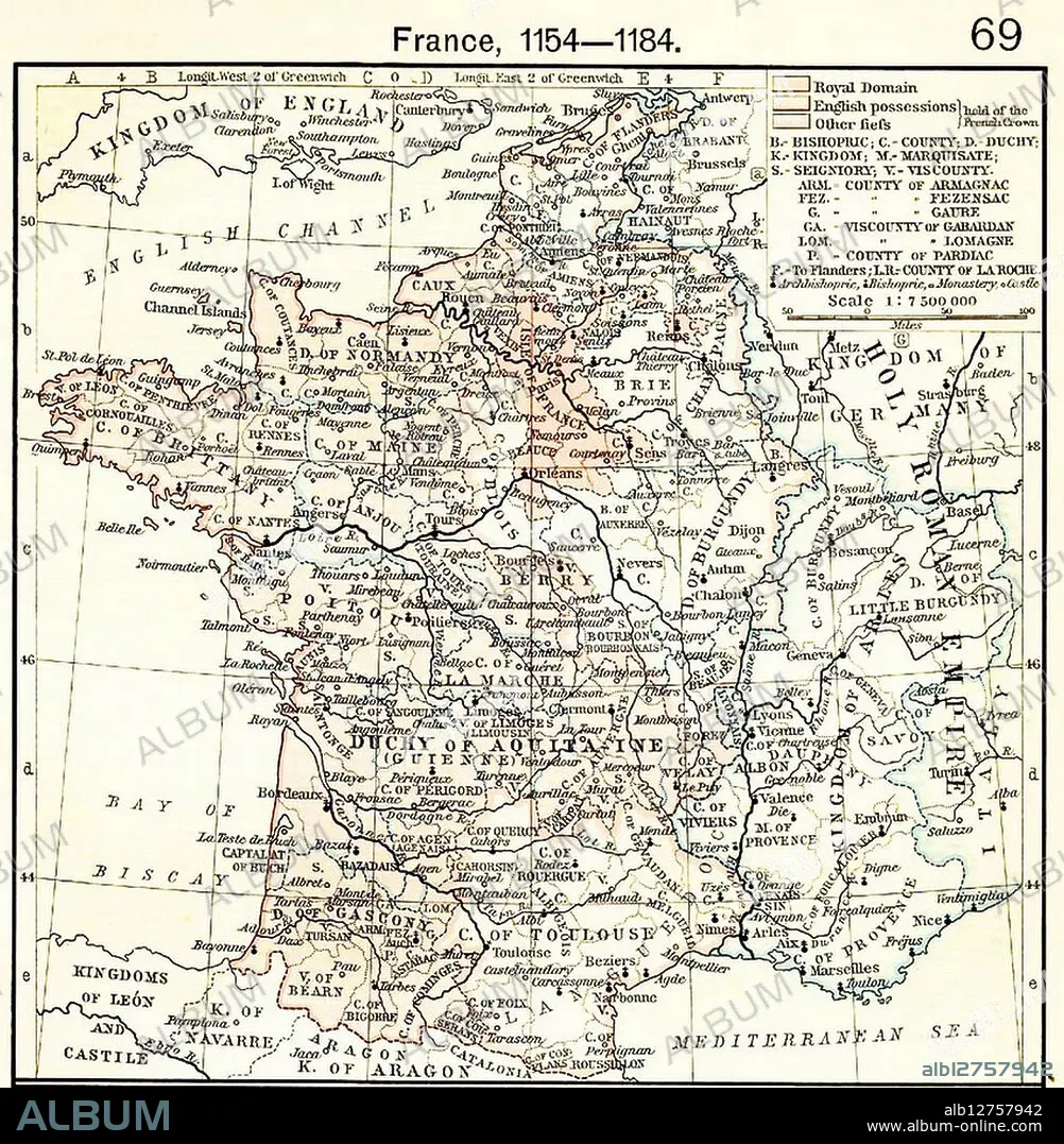
Map showing Aquitaine and Angevin English territories.
| Share |
|---|
 Pinterest Pinterest |
 Twitter Twitter |
 Facebook Facebook |
 Copy link Copy link |
 Email Email |
|
Add to another lightbox |
|
Add to another lightbox |


Buy this image.
Select the use:

Title:
Map showing Aquitaine and Angevin English territories.
Caption:
France, 1154-1184 Map showing Aquitaine and Angevin English territories.
Credit:
Album / Universal History Archive/Universal Images Group
Releases:
Image size:
4000 x 4089 px | 46.8 MB
Print size:
33.9 x 34.6 cm | 13.3 x 13.6 in (300 dpi)
Keywords:
ANGEVIN • AQUITAINE • BORDER • BRITISH • CONQUERING • CONQUEST • CROWN • DOMAIN • DUKE • EMPIRE • ENGLISH • EUROPA • EUROPE • EXPANSION • FRANCE • FRANCE. • GEOGRAFIA • GEOGRAPHY • HISTORIA UNIVERSAL • HISTORIA • HISTORICAL • HISTORY • HISTORY. • INGLES • KING • LA FRANCE • LAND • MAP • MAPS • MEDIEVAL • MIDDLE AGES • MONARCHY • NORMAN • PLAN (CARTOGRAPHY) • PLANTAGENÊT • POLICY • POLITIC • POLITICAL • POLITICIAN • POLITICS • POWER • QUEEN VICTORIA I • QUEEN VICTORIA • QUEEN • QUEENS • REGION • ROYAL • RULER • STATESMAN • TERRITORIES • TERRITORY • TRIUMPH • UNSPECIFIED • VICTORIA I • VICTORY
