alb4284910
Map of the Battle of Verdun
| Share |
|---|
 Pinterest Pinterest |
 Twitter Twitter |
 Facebook Facebook |
 Copy link Copy link |
 Email Email |
|
Add to another lightbox |
|
Add to another lightbox |


Buy this image.
Select the use:

Title:
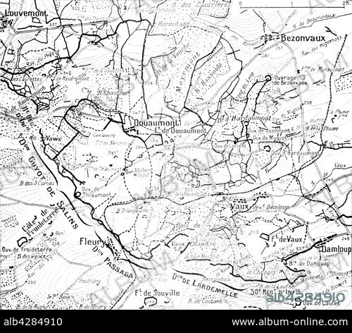
Map of the Battle of Verdun
Caption:
First World War.. Map of positions at the time of the Battle of Verdun and the land around the forsts of Douaumont and Vaux with an indication of attacking front lines of the French divisions on 24th October 1916.
Credit:
Album / Photo12/Archives Snark
Releases:
Image size:
4862 x 4272 px | 59.4 MB
Print size:
41.2 x 36.2 cm | 16.2 x 14.2 in (300 dpi)
Keywords:
