alb6179404
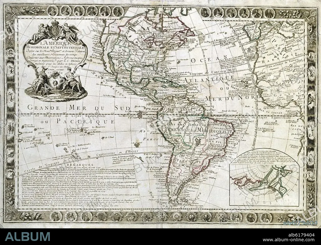
LOUIS CHARLES DESNOS. MAP OF SOUTH AMERICA AND NORTH AMERICA - 1760.
 Pinterest
 Twitter
 Facebook
 Copy link
 Email
Email


Buy this image.
Select the use:

Title:
MAP OF SOUTH AMERICA AND NORTH AMERICA - 1760.
Caption:
MAP OF SOUTH AMERICA AND NORTH AMERICA - 1760
Location:
Credit:
Album / Oronoz
Warning:
The use of this Visual Content may require additional permissions. In the event that the work depicted is not in the public domain in the country where the licence is exploited, the rights of the visual artist or his/her successors in title must be obtained and cleared in accordance with applicable law.
Releases:
Image size:
6078 x 4320 px | 75.1 MB
Print size:
51.5 x 36.6 cm | 20.3 x 14.4 in (300 dpi)
Keywords:
18TH CENTURY • 18TH CENTURY, THE • 18TH CENTURY. • 18TH • AMERICA • AMERICA. • AMERICAS • AMERICAS, THE • ARCHIVO HISTORICO MILITAR • CARTOGRAPHY • DESNOS L. C. • ECUADOR PARALLEL • FRENCH WRITING • MADRID MILITARY FILE • MADRID • MAP MAKING • MAP • MAPS • MILITARY HISTORICAL ARCHIVE IN MADRID • OLD MAP • PLAN (CARTOGRAPHY) • SPAIN • TROPIC OF CANCER • TROPIC OF CAPRICORN • XVIII CENTURY
