alb4057434
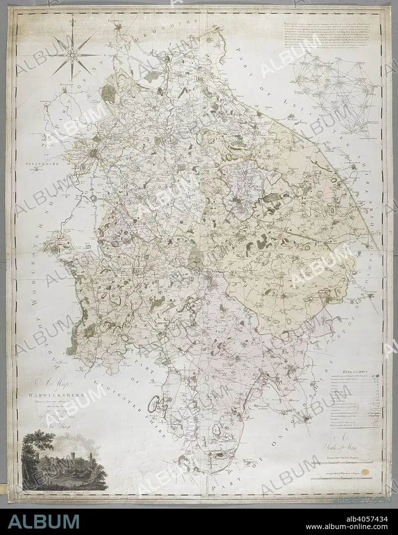
WILLIAM YATES AND SONS. A Map of Warwickshire, 1787. A Map of Warwickshire, drawn from an actual survey taken in the years 1787, 8, 9 by W. Yates and Sons. Warwick, 1793. Source: Maps K.Top.42.76.11.Tab.
| Share |
|---|
 Pinterest Pinterest |
 Twitter Twitter |
 Facebook Facebook |
 Copy link Copy link |
 Email Email |
|
Add to another lightbox |
|
Add to another lightbox |


Author:
Caption:
A Map of Warwickshire, 1787. A Map of Warwickshire, drawn from an actual survey taken in the years 1787, 8, 9 by W. Yates and Sons. Warwick, 1793. Source: Maps K.Top.42.76.11.Tab.
Credit:
Album / British Library
Releases:
Model: No - Property: No
Rights questions?
Rights questions?
Image size:
8296 x 10595 px | 251.5 MB
Print size:
70.2 x 89.7 cm | 27.7 x 35.3 in (300 dpi)
Keywords:
18TH CENTURY • 18TH CENTURY, THE • 18TH • ALBION • BRITISH ISLES • CARTE • CARTOGRAPHIC • CARTOGRAPHY • COLOR • COLORS • COLOUR • COLOURS • ENGLAND'S • ENGLAND • EUROPA • EUROPE • GREAT BRITAIN • MAP MAKING • MAP • MAPS • PLAN (CARTOGRAPHY) • U. K. • WARWICKSHIRE • WESTERN EUROPE • XVIII CENTURY • YATES AND SONS, WILLIAM
