alb9840143
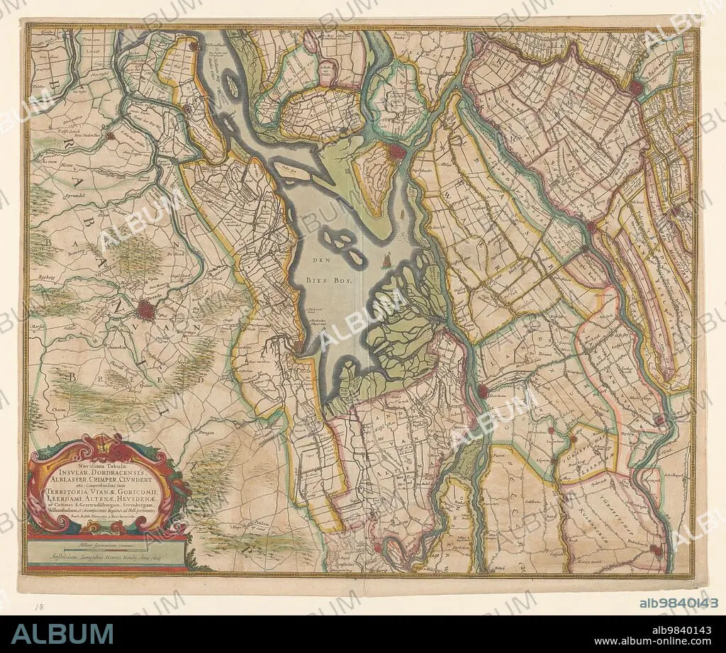
BALTHASAR FLORISZ. VAN BERCKENRODE. Map of parts of North Brabant, South Holland and Gelderland, 1629. Creator: Balthasar Florisz. van Berckenrode.
| Share |
|---|
 Pinterest Pinterest |
 Twitter Twitter |
 Facebook Facebook |
 Copy link Copy link |
 Email Email |
|
Add to another lightbox |
|
Add to another lightbox |


Buy this image.
Select the use:

Title:
Map of parts of North Brabant, South Holland and Gelderland, 1629. Creator: Balthasar Florisz. van Berckenrode.
Caption:
Map of parts of North Brabant, South Holland and Gelderland, 1629. The surroundings of the Bies Bos, sailing ship. Bottom left a cartouche with the title with the scale in German miles (1: 100,000).
Technique/material:
ETCHING
Credit:
Album / Heritage Art/Heritage Images
Releases:
Image size:
5056 x 4284 px | 62.0 MB
Print size:
42.8 x 36.3 cm | 16.9 x 14.3 in (300 dpi)
Keywords:
17TH CENTURY • ART • ARTS • BALTESER • BALTHASAR FLORISZ VAN BERCKENRODE • BALTHASAR FLORISZ VAN • BALTHASAR FLORISZ. VAN BERCKENRODE • BALTHASAR FLORISZ. VAN • BERCKENRODE • BERKENRODE • BIESBOSCH • BRABANT • CENTURY • COLOR • COLOUR • DUTCH • ETCHING • EUROPE • FLORIS BALTESER • FLORIS BATHASAR BERKENRODE • FLORIS BATHASAR • FLORIS • FLUSH • GELDERLAND • GEOGRAFIA • GEOGRAPHICAL FEATURE • GEOGRAPHY • HENRICUS HONDIUS • HENRICUS • HONDIUS • LAKE • LOCATION • LOW COUNTRIES • MAP • MUSEUM • NETHERLANDS • PAPER • RIJKSMUSEUM • SEVENTEENTH CENTURY • WATERCOLOUR (PAINT) • WATERCOLOUR
