alb3280629
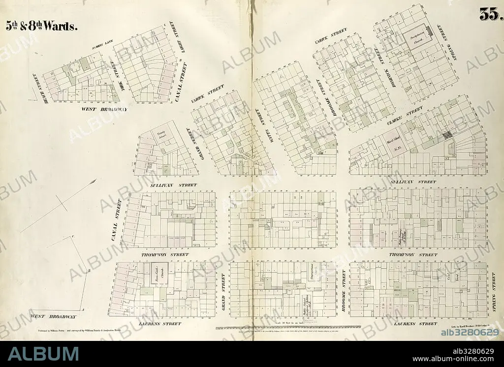
Plate 35: Map bounded by Spring Street, Laurens Street, Canal Street, West Broadway, Beach Street, St. John's Lane, Laight Street, Canal Street, Varick Street. 1852, 1854, William Perris, New York, N.Y., USA.
| Share |
|---|
 Pinterest Pinterest |
 Twitter Twitter |
 Facebook Facebook |
 Copy link Copy link |
 Email Email |
|
Add to another lightbox |
|
Add to another lightbox |


Buy this image.
Select the use:

Caption: Plate 35: Map bounded by Spring Street, Laurens Street, Canal Street, West Broadway, Beach Street, St. John's Lane, Laight Street, Canal Street, Varick Street. 1852, 1854, William Perris, New York, N.Y., USA
Credit: Album / quintlox
Releases: ? Model Release: No - ? Property Release: No
Rights questions?
Rights questions?
Image size: 6039 × 4086 px | 70.6 MB
Print size: 51.1 × 34.6 cm | 2377.6 × 1608.7 in (300 dpi)
Keywords: 1854 • AMERICA • AMERICA. • AMERICAS • AMERICAS, THE • BEACH STREET • CANAL STREET • CARTOGRAPHIC • CARTOGRAPHY • EEUU • GEOGRAFIA • GEOGRAPHY • HISTORIC MAP • LAIGHT STREET • LAURENS STREET • MANHATTAN, NEW YORK • MAP BOUNDED BY • MAP MAKING • MAP • MAPS • NEW YORK CITY • NEW YORK • NEW YORK, USA • NY • OLD MAP • PLAN (CARTOGRAPHY) • PLATE 35 • SPRING STREET • ST JOHN'S LANE • U S A • U. S. A • U. S. A. • UNITED STATES AMERICA • UNITED STATES OF AMERICA • UNITED STATES • US-AMERICAN • USA • USA. UNITED STATES • VARICK STREET 1852 • VINTAGE MAP • WEST BROADWAY • WILLIAM PERRIS
