alb10616026
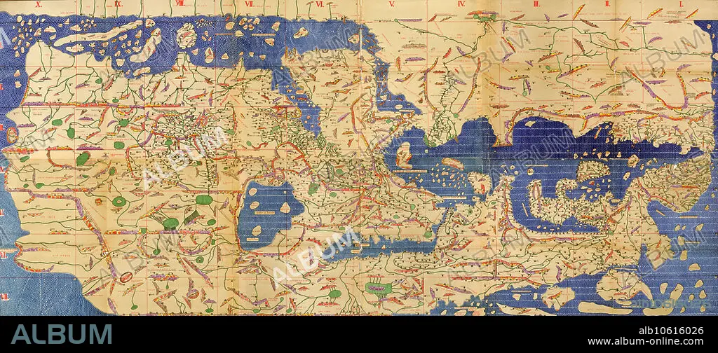
Tabula Rogeriana, Drawn by Al-Idrisi, 1154
| Share |
|---|
 Pinterest Pinterest |
 Twitter Twitter |
 Facebook Facebook |
 Copy link Copy link |
 Email Email |
|
Add to another lightbox |
|
Add to another lightbox |


Buy this image.
Select the use:

Title:
Tabula Rogeriana, Drawn by Al-Idrisi, 1154
Caption:
The Tabula Rogeriana, drawn by Al-Idrisi for Roger II of Sicily in 1154, was one of the most advanced world maps of its era, showing Europe, Asia, and part of Africa. Muhammad al-Idrisi was an Arab Muslim geographer, cartographer and Egyptologist who lived in Palermo, Sicily at the court of King Roger II.
Credit:
Album / Science Source
Releases:
Model: No - Property: No
Rights questions?
Rights questions?
Image size:
8100 x 3567 px | 82.7 MB
Print size:
68.6 x 30.2 cm | 27.0 x 11.9 in (300 dpi)
