alb3549034
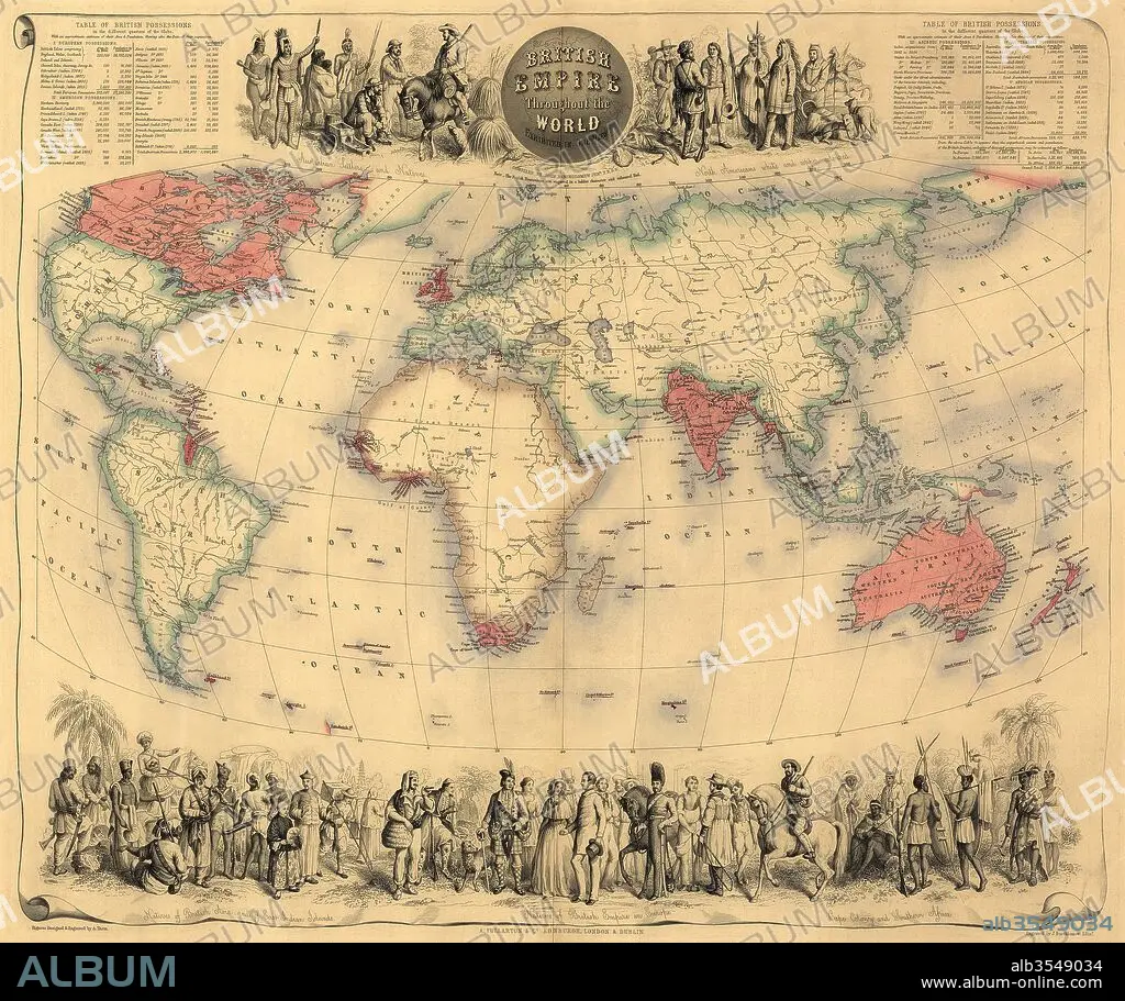
Map of the world circa 1870 with possessions of the British Empire coloured red
| Share |
|---|
 Pinterest Pinterest |
 Twitter Twitter |
 Facebook Facebook |
 Copy link Copy link |
 Email Email |
|
Add to another lightbox |
|
Add to another lightbox |


Buy this image.
Select the use:

Title:
Map of the world circa 1870 with possessions of the British Empire coloured red
Caption:
Map of the world circa 1870 with possessions of the British Empire coloured red. The map first appeared in Fullarton's Royal Illustrated Atlas, published 1864.
Credit:
Album / Universal Images Group / Universal History Archive
Releases:
Model: No - Property: No
Rights questions?
Rights questions?
Image size:
5115 x 4287 px | 62.7 MB
Print size:
43.3 x 36.3 cm | 17.1 x 14.3 in (300 dpi)
Keywords:
1870'S • 1870 • 19 CENTURY • 19TH CENTURY • 19TH CENTURY. • 19TH • 19TH-CENTURY • BRITAIN • BRITISH EMPIRE • BRITISH • CARTOGRAPHY • CENTURY • CHART • CIRCA • COLOR • COLOUR • DECORATIVE • EMPIRE • ENGLAND'S • ENGLAND • ENGLISH • EXTENT • GREAT BRITAIN • GREAT-BRITAIN • ILLUSTRATED • INGLES • MAP MAKING • MAP • MAPS • NINETEENTH CENTURY • NINETEENTH • PLAN (CARTOGRAPHY) • POSSESSIONS • U. K. • UNITED KINGDOM • WORLD WIDE • WORLD • WORLDWIDE • XIX CENTURY
