alb5530856
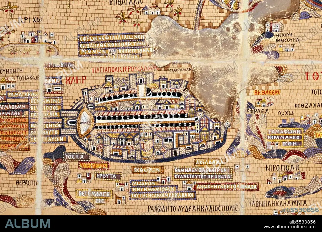
Jordan / Israel / Palestine: Detail of a reproduction of the 6th century CE Madaba Map mosaic showing Old Jerusalem protected by oval-shaped city walls. Kleopas Koikylides, c. 1897
| Share |
|---|
 Pinterest Pinterest |
 Twitter Twitter |
 Facebook Facebook |
 Copy link Copy link |
 Email Email |
|
Add to another lightbox |
|
Add to another lightbox |


Buy this image.
Select the use:

Title: Jordan / Israel / Palestine: Detail of a reproduction of the 6th century CE Madaba Map mosaic showing Old Jerusalem protected by oval-shaped city walls. Kleopas Koikylides, c. 1897
Caption: The Madaba Map (also known as the Madaba Mosaic Map) is part of a floor mosaic in the early Byzantine church of Saint George at Madaba, Jordan. The Madaba Map is a map of the Middle East. Part of it contains the oldest surviving original cartographic depiction of the Holy Land and especially Jerusalem. It dates to the 6th century CE.
Credit: Album / Pictures From History/Universal Images Group
Releases: ? Model Release: No - ? Property Release: No
Rights questions?
Rights questions?
Image size: 5100 × 3416 px | 49.8 MB
Print size: 43.2 × 28.9 cm | 2007.9 × 1344.9 in (300 dpi)
Keywords: 1897 • 6TH CENTURY A. D. • 6TH CENTURY • 6TH • AL QUDS • ASIA • ASIAN • BYZANTINE • BYZANTIUM • CARDS • CARTOGRAPHY • CHART • CHARTS • CHURCH OF SAINT GEORGE • CHURCH OF ST GEORGE • DAVID • ERETZ ISRAEL • HISTORIC PALESTINE • HOLY LAND • ISRAEL • ISRAELI • JERUSALEM AL QUDS • JERUSALEM • JEW • JEWISH • JEWS • JORDAN • JORDANIAN • KLEOPAS • KOIKYLIDES • LEVANT • MADABA MAP • MADABA • MAP MAKING • MAP • MAPS • MIDDLE EAST • MUSLIM WORLD • PALESTINAN • PALESTINE • PALESTINIAN • PALESTINIANS • PLAN (CARTOGRAPHY) • RELIGION • WAILING WALL
