alb1656551
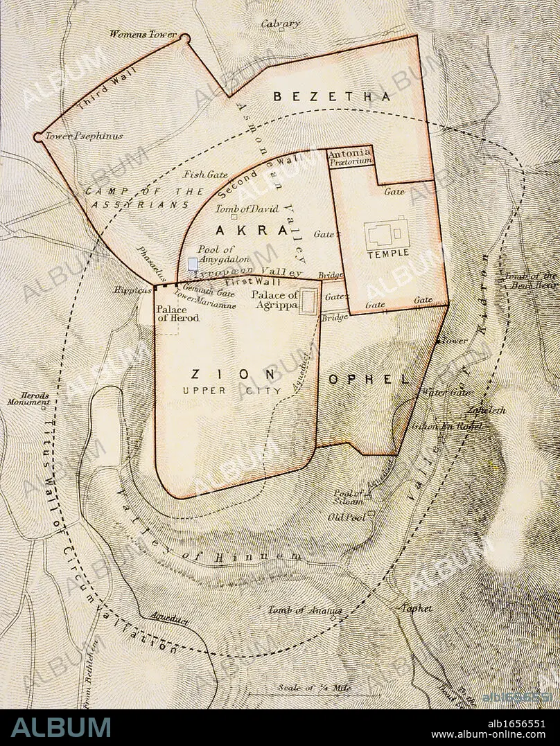
City map of ancient Jerusalem From The Citizen's Atlas of the World published London circa 1899.
| Share |
|---|
 Pinterest Pinterest |
 Twitter Twitter |
 Facebook Facebook |
 Copy link Copy link |
 Email Email |
|
Add to another lightbox |
|
Add to another lightbox |


Caption:
City map of ancient Jerusalem From The Citizen's Atlas of the World published London circa 1899
Credit:
Album / Universal History Archive/Universal Images Group
Releases:
Model: No - Property: No
Rights questions?
Rights questions?
Image size:
3822 x 4843 px | 53.0 MB
Print size:
32.4 x 41.0 cm | 12.7 x 16.1 in (300 dpi)
Keywords:
19TH CENTURY • 19TH • ANCIENT • ANTIQUE • ATLAS • BIBLICAL • CENTURY • CITY • COLOR • COLOUR • JERUSALEM • KEN • MAP • MAPS • NINETEENTH • OLD TESTAMENT • OLD • PLAN (CARTOGRAPHY) • PLAN • TOWN • TOWNS • VERTICAL LINES • VERTICAL • WELSH • XIX CENTURY
