alb4011016
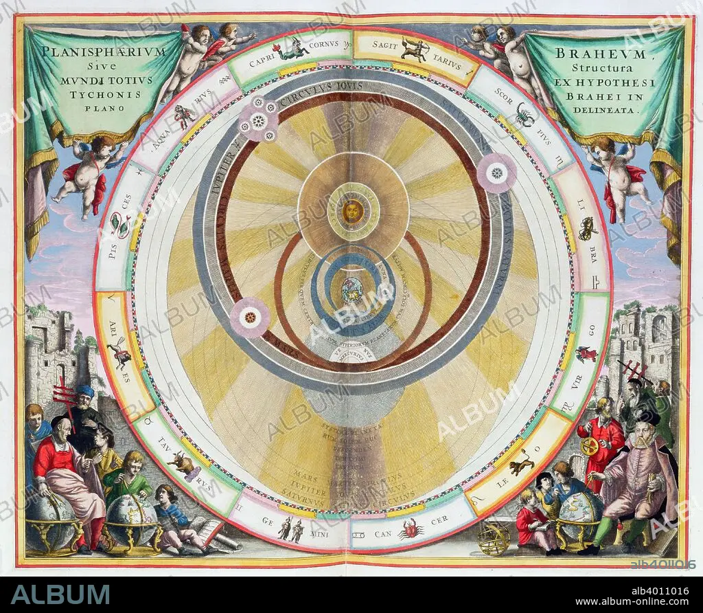
Map showing Tycho Brahe's system of planetary orbits, 1660-1661. Artist: Andreas Cellarius
| Share |
|---|
 Pinterest Pinterest |
 Twitter Twitter |
 Facebook Facebook |
 Copy link Copy link |
 Email Email |
|
Add to another lightbox |
|
Add to another lightbox |


Title:
Map showing Tycho Brahe's system of planetary orbits, 1660-1661. Artist: Andreas Cellarius
Caption:
Map showing Tycho Brahe's system of planetary orbits, 1660-1661. From The Celestial Atlas, or The Harmony of the Universe (Atlas coelestis seu harmonia macrocosmica) by Andreas Cellarius, published by Johannes Janssonius, (Amsterdam 1660-1661).
Credit:
Album / Heritage Images / Historica Graphica Collection
Releases:
Model: No - Property: No
Rights questions?
Rights questions?
Image size:
4648 x 3809 px | 50.7 MB
Print size:
39.4 x 32.2 cm | 15.5 x 12.7 in (300 dpi)
Keywords:
17TH CENTURY • ANDREAS CELLARIUS • ANDREAS • ASTROLOGY • ASTRONOMY • BRAHE • CELLARIUS • CENTURY • COLOR • COLOUR • COUNTRY • DANISH • DENMARK • DUTCH • EARTH • ENGRAVING • HOLLAND • LOCATION • MAP • ORBIT • OUTERSPACE • PEOPLE • PLANET • SCIENCE • SEVENTEENTH CENTURY • SIGN • SOLAR SYSTEM • SPACE (COSMOS) • SPACE • SPATIAL • STAR SIGN • THEORY • TYCHO BRAHE • TYCHO
