alb9433967
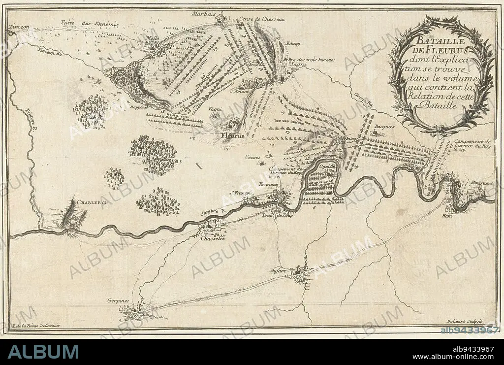
Map of the Fleurus area near Charleroi showing the positions of the armies at the battle of Fleurus, a victory of the French under the Duke of Luxembourg over the Allied army under the Prince of Waldeck, 1 July 1690, Battle of Fleurus, 1690 Bataille de Fleurus , print maker: Juan Dolívar, (mentioned on object), intermediary draughtsman: François de La Pointe, (mentioned on object), France, 1690, paper, etching, h 243 mm × w 370 mm.
| Share |
|---|
 Pinterest Pinterest |
 Twitter Twitter |
 Facebook Facebook |
 Copy link Copy link |
 Email Email |
|
Add to another lightbox |
|
Add to another lightbox |


Buy this image.
Select the use:

Caption:
Map of the Fleurus area near Charleroi showing the positions of the armies at the battle of Fleurus, a victory of the French under the Duke of Luxembourg over the Allied army under the Prince of Waldeck, 1 July 1690, Battle of Fleurus, 1690 Bataille de Fleurus , print maker: Juan Dolívar, (mentioned on object), intermediary draughtsman: François de La Pointe, (mentioned on object), France, 1690, paper, etching, h 243 mm × w 370 mm
Personalities:
Credit:
Album / quintlox
Releases:
Model: No - Property: No
Rights questions?
Rights questions?
Image size:
5590 x 3754 px | 60.0 MB
Print size:
47.3 x 31.8 cm | 18.6 x 12.5 in (300 dpi)
Keywords:
1 JULY 1690 • 1690 BATAILLE DE FLEURUS • 1690 • ALLIED ARMY UNDER • ARMIES ARMY • ARMIES • ARMY • BATTLE • CHARLEROI SHOWING • COMBAT • DISPUTE • DUKE • ETCHING • FIGHT • FIGHTING • FLEURUS AREA • FLEURUS • FRANCE • FRANÇOIS DE LA POINTE • FRENCH UNDER • H 243 MM × W 370 MM • INTERMEDIARY DRAUGHTSMAN • JUAN DOLIVAR • LUXEMBOURG • MAP • MAPS • MENTIONED • OBJECT • OBJECTS • PAPER AND PACKAGE PRODUCTS • PAPER • PLAN (CARTOGRAPHY) • POSITIONS • PRINCE • PRINT MAKER • SCUFFLE • STRUGGLE • UMBRELLA • VICTORY • WALDECK
