alb3828222
Typhoon, Navy Ship Radar
| Share |
|---|
 Pinterest Pinterest |
 Twitter Twitter |
 Facebook Facebook |
 Copy link Copy link |
 Email Email |
|
Add to another lightbox |
|
Add to another lightbox |


Buy this image.
Select the use:

Title:
Typhoon, Navy Ship Radar
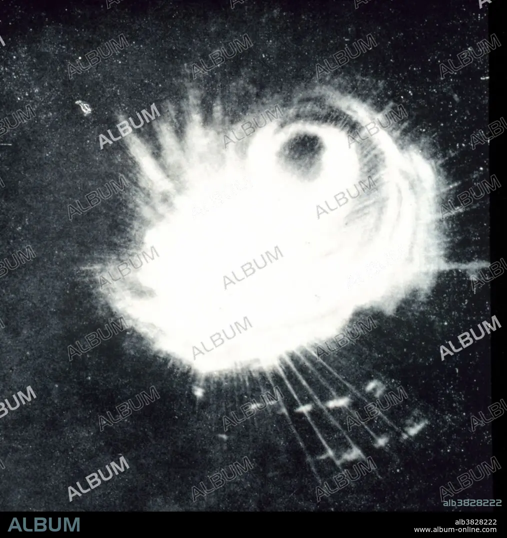
Caption:
Structure of a typhoon captured by a Navy ship's radar. This storm was the second tropical storm to ever be observed on radar. Philippine Islands, area to east. December 18, 1944. A typhoon is a tropical cyclone or hurricane of the western Pacific area and the China seas.
Credit:
Album / NOAA/Science Source
Releases:
Model: No - Property: No
Rights questions?
Rights questions?
Image size:
3300 x 3334 px | 31.5 MB
Print size:
27.9 x 28.2 cm | 11.0 x 11.1 in (300 dpi)
Keywords:
1944 • 20 20TH XX XXTH TWENTIETH CENTURY • 20 XX TWENTIETH CENTURY • 20TH CENTURY • 20TH • AMERICA • AMERICAN • ATMOSPHERIC CONDITIONS • ATMOSPHERIC • BW • HISTORIC • HISTORICAL • HISTORY • INTENSE • ISLA • ISLAND • ISLANDS • METEOROLOGICAL FORECAST • METEOROLOGICAL • METEOROLOGY • METEOROLOGY • MILITARY • NATIONAL WEATHER SERVICE • NATURAL PHENOMENA • NATURAL PHENOMENON • NAVY • NWS • OBSERVATION • PHILIPPINE • RADAR • SCANNING SYSTEM • SCIENCE • SÉVÈRE • STORM DATA • STORM • STRONG WEATHER • TRACKING SYSTEM • TROPICAL CYCLONE • TROPICAL HURRICANE • TROPICAL STORM • TWENTIETH CENTURY • TYPHOON • UNITED STATES • US • USA • VIOLENT • WEATHER DATA • WEATHER EVENT • WEATHER FORECAST • WEATHER PREDICTION • WEATHER RADAR • WEATHER TRACKING • WEATHER • WESTERN PACIFIC
