alb2595413
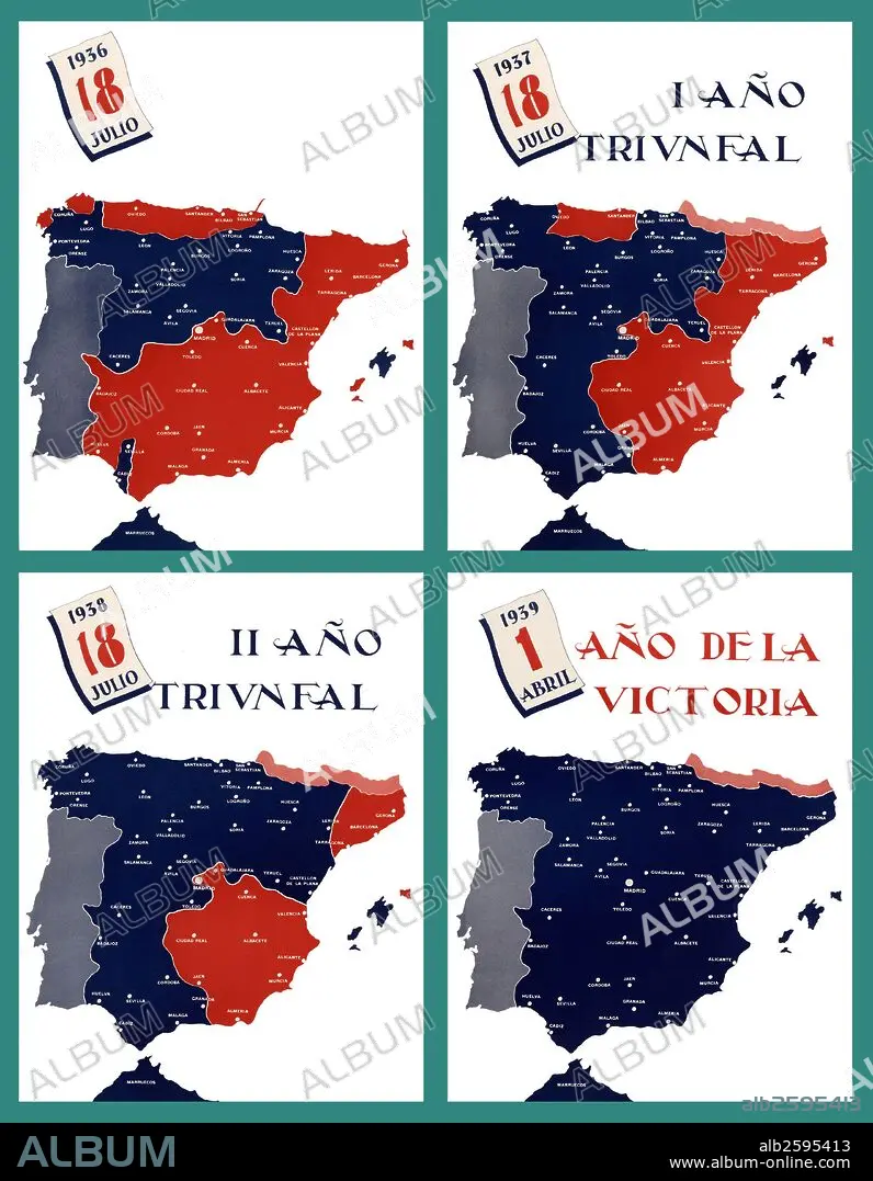
Mapa de España y distribución de los dos bandos contendientes durante el período de la guerra civil (1936-1939).
| Share |
|---|
 Pinterest Pinterest |
 Twitter Twitter |
 Facebook Facebook |
 Copy link Copy link |
 Email Email |
|
Add to another lightbox |
|
Add to another lightbox |


Buy this image.
Select the use:

Caption:
Automatic translation: Map of Spain and distribution of the two contending sides during the period of the civil war (1936-1939)
Mapa de España y distribución de los dos bandos contendientes durante el período de la guerra civil (1936-1939).
Credit:
Album / Documenta
Releases:
Image size:
4300 x 5533 px | 68.1 MB
Print size:
36.4 x 46.8 cm | 14.3 x 18.4 in (300 dpi)
Keywords:
20TH CENTURY • BORDER • CIVIL WAR • CONTEST • ESPANA • MAP • MAPS • PLAN (CARTOGRAPHY) • SPAIN • TERRITORY
