alb3123202
Berlin Blockade Map.
| Share |
|---|
 Pinterest Pinterest |
 Twitter Twitter |
 Facebook Facebook |
 Copy link Copy link |
 Email Email |
|
Add to another lightbox |
|
Add to another lightbox |


Buy this image.
Select the use:

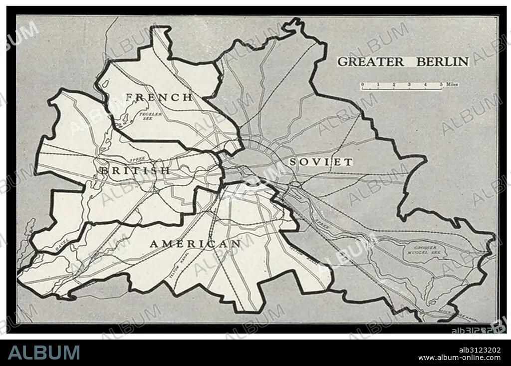
Title: Berlin Blockade Map.
Caption: Berlin Blockade Map 1948. The Berlin Blockade (1 April 1948 – 12 May 1949) was one of the first major international crises of the Cold War. During the multinational occupation of post–World War II Germany, the Soviet Union blocked the Western Allies' railway, road, and canal access to the sectors of Berlin under Western control.
Credit: Album / Universal Images Group / Universal History Archive
Releases: ? Model Release: No - ? Property Release: No
Rights questions?
Rights questions?
Image size: 5100 × 3386 px | 49.4 MB
Print size: 43.2 × 28.7 cm | 2007.9 × 1333.1 in (300 dpi)
Keywords: 1940 • 1940S • 20 20TH XX XXTH TWENTIETH CENTURY • 20 XX TWENTIETH CENTURY • 20TH CENTURY • 20TH • BERLIN • BLOCKADE • CANAL • COLD WAR • CRISIS • GERMANY • GUERRA • HUNDRED YEARS WAR • II WORLD WAR • INTERNATIONAL CRISIS • MAP • MAPS • OCCUPATION • PLAN (CARTOGRAPHY) • POST–WAR • RAILWAY • ROAD • ROADS • SECOND WORLD WAR • SOVIET UNION • TWENTIETH CENTURY • WAR (WORLD WORLD 2) • WAR • WARFARE • WARS • WESTERN CONTROL • WESTERN • WORLD WAR 2 • WORLD WAR II • WORLD WAR TWO • WW II • WWII
